| home | virtual field trips | regional geology | images | e-learning | links |
|
|
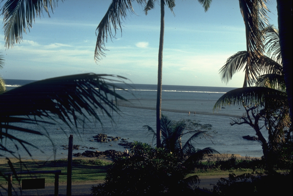
| Image information: south coast of Viti Levu, Fiji. View from near Korolevu. Photo: Roger Suthren, 1984. |
This is a view from the shore, southwards across the fringing reef of Fiji's main island. The photo was taken at high tide, and the reef top is submerged under 1 metre or so of water. At low tide, much of the reef top is emergent. Thus, there is no lagoon, and the reef is attached directly to the shore. Explore the area in Google Maps.
About 1 km from the beach, the line of surf marks the reef crest - beyond this point, the reef front drops off rapidly into the deep ocean. During normal weather conditions, most of the wave energy is dissipated at the reef crest. During tropical storms, however, storm waves may affect the whole of the reef top, and the shoreline beyond, causing destruction of colonial reef builders, and major transport and deposition of carbonate sediment.
The dark, curved line across the reef top is a fissure formed by uplift of the reef during an earthquake.
| Back to Reefs and Build-ups Lecture |
![]()
![]()
This page is maintained by Roger Suthren. Last updated 16 March, 2021 2:39 PM