It is important that you access this field trip on a laptop or desktop PC. Click on any image to enlarge it.
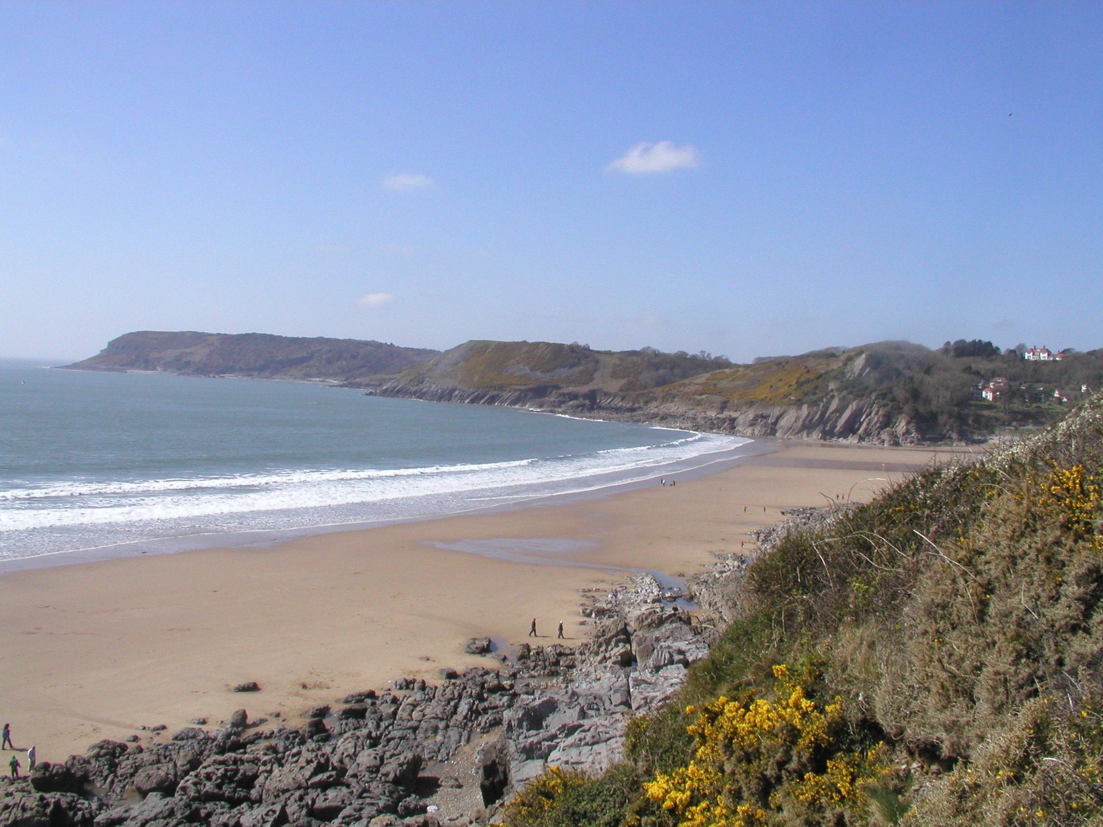
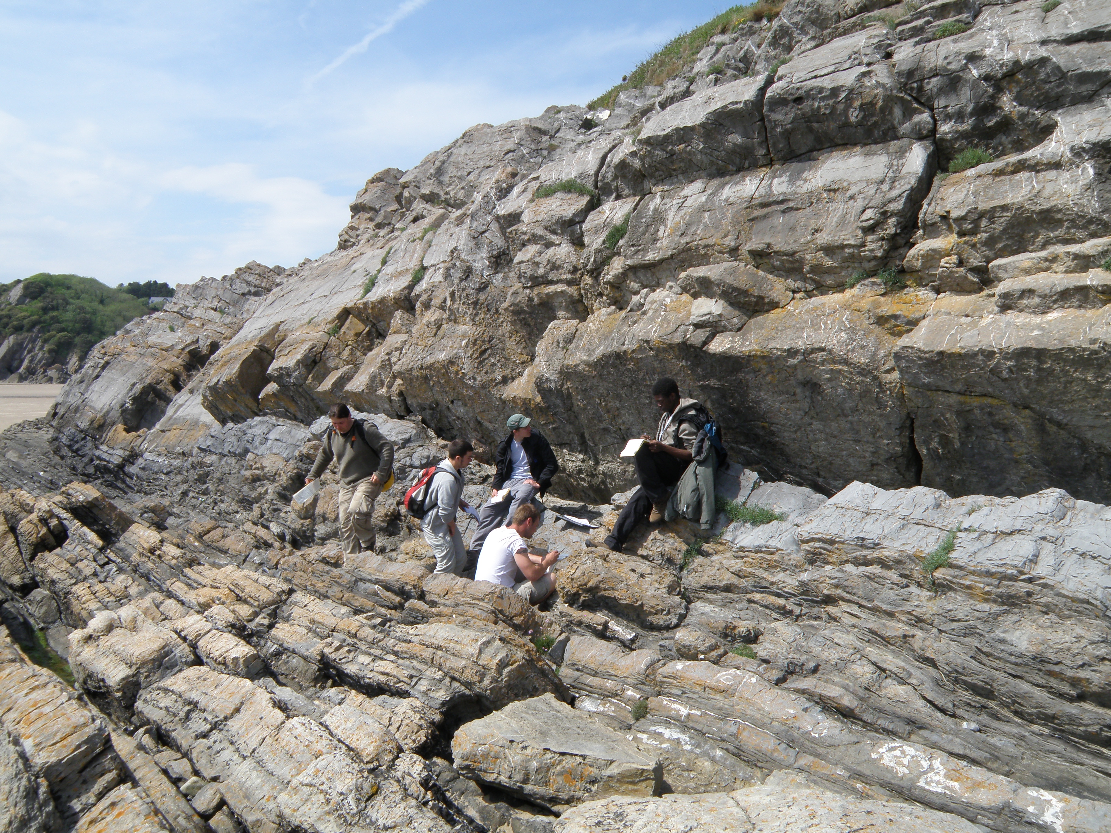
Where are we? Today we've driven east to the South Glamorgan coast, on the beautiful Gower Peninsula near Swansea. Study the area in Google Maps and Streetview.
At this location, our logged section takes us through several major units of the Pembroke Limestone Group (Lower Carboniferous), in stratigraphic order from the base.
Handout: refer to the handout for today, which contains essential diagrams and information. Don't forget to use the information in the Field Guide too. Both are available in Course Resources.
Tasks: See today's handout. Record all your observations in your virtual notebook.
|
Question |
|
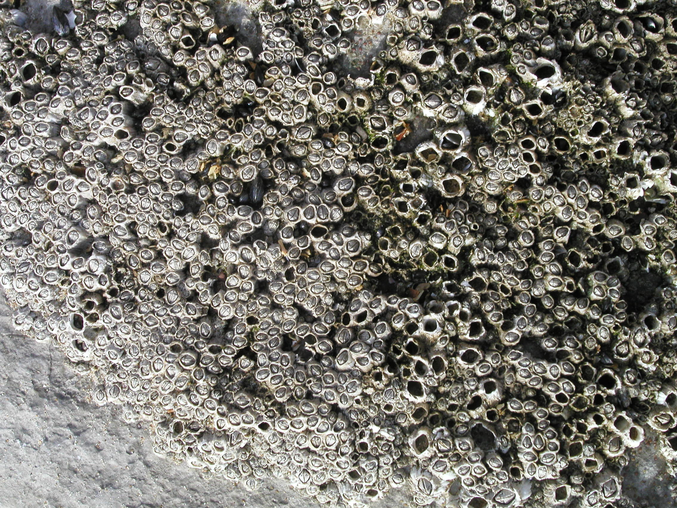
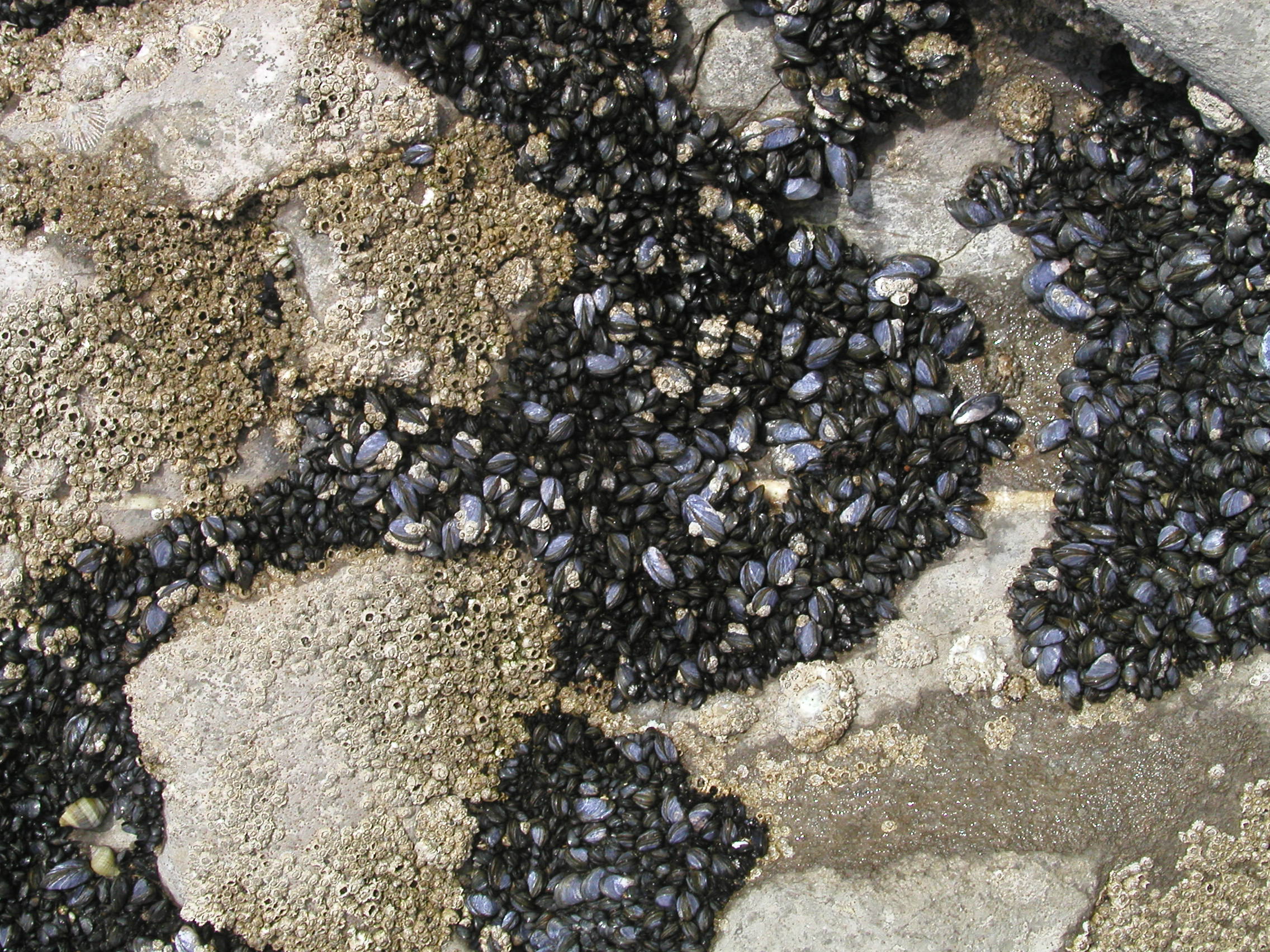 C. Our goal is to study ancient carbonates, but here are some modern carbonate-producing organisms in the intertidal zone at this location What are the organisms shown? Try to classify them. Which of them are geologically important as sediment formers?
|
 D. What are these organisms? What are their closest relatives? |
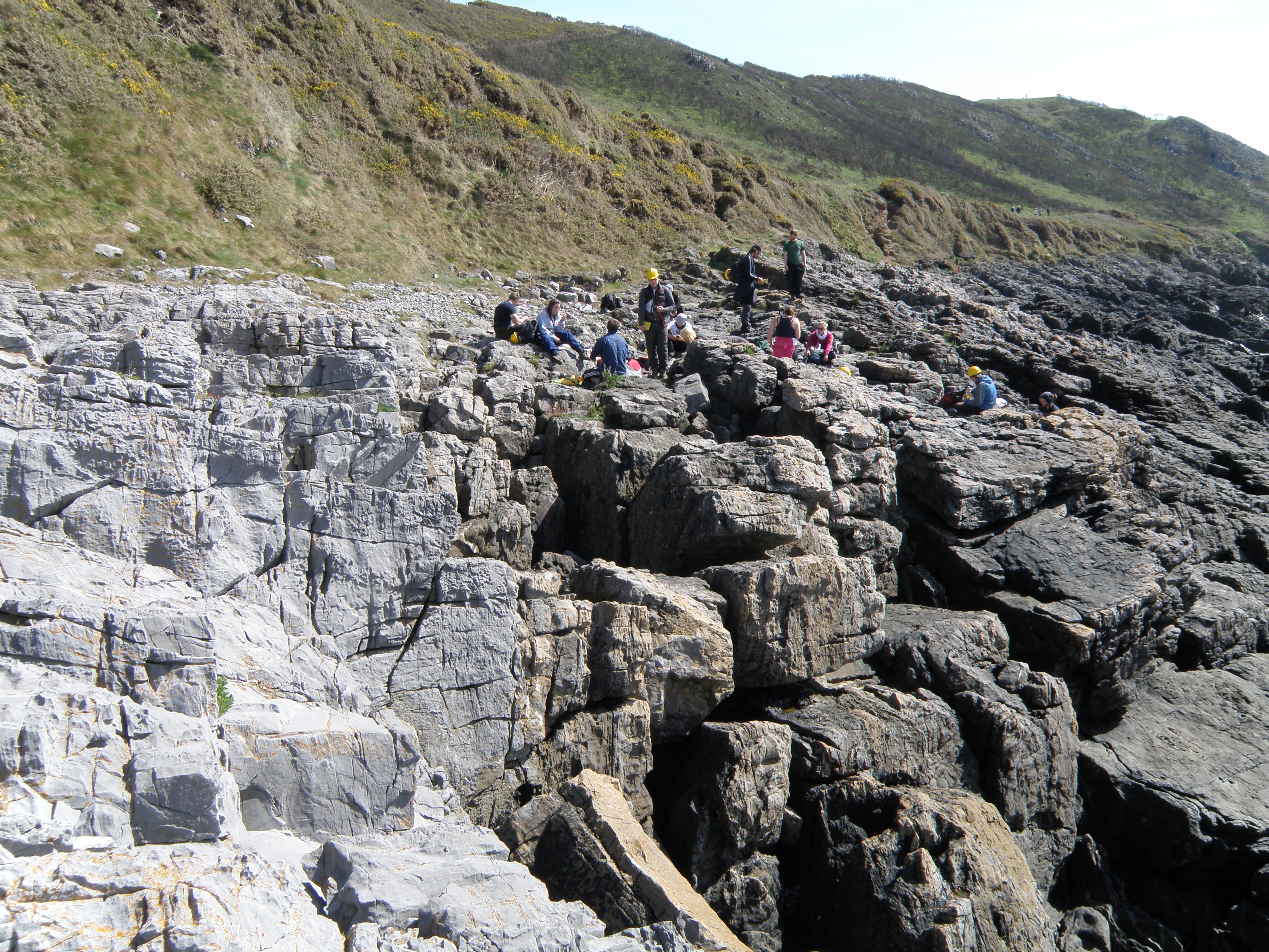
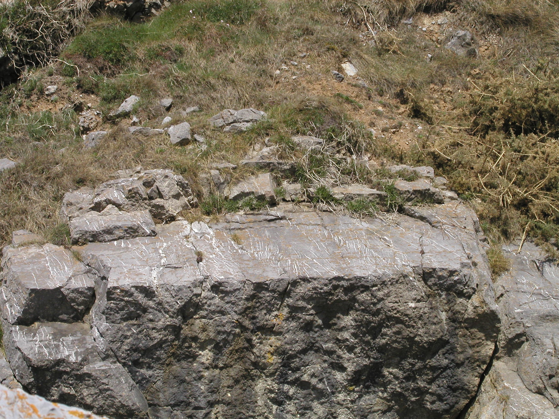 E. The rocks here show strong Variscan deformation, including folding and thrusting. On a small scale, much of the deformation is brittle, as we would expect in competent, rigid limestones. Here are some fine sets of tension gashes. |
 F. Minor faults and shear zones. |
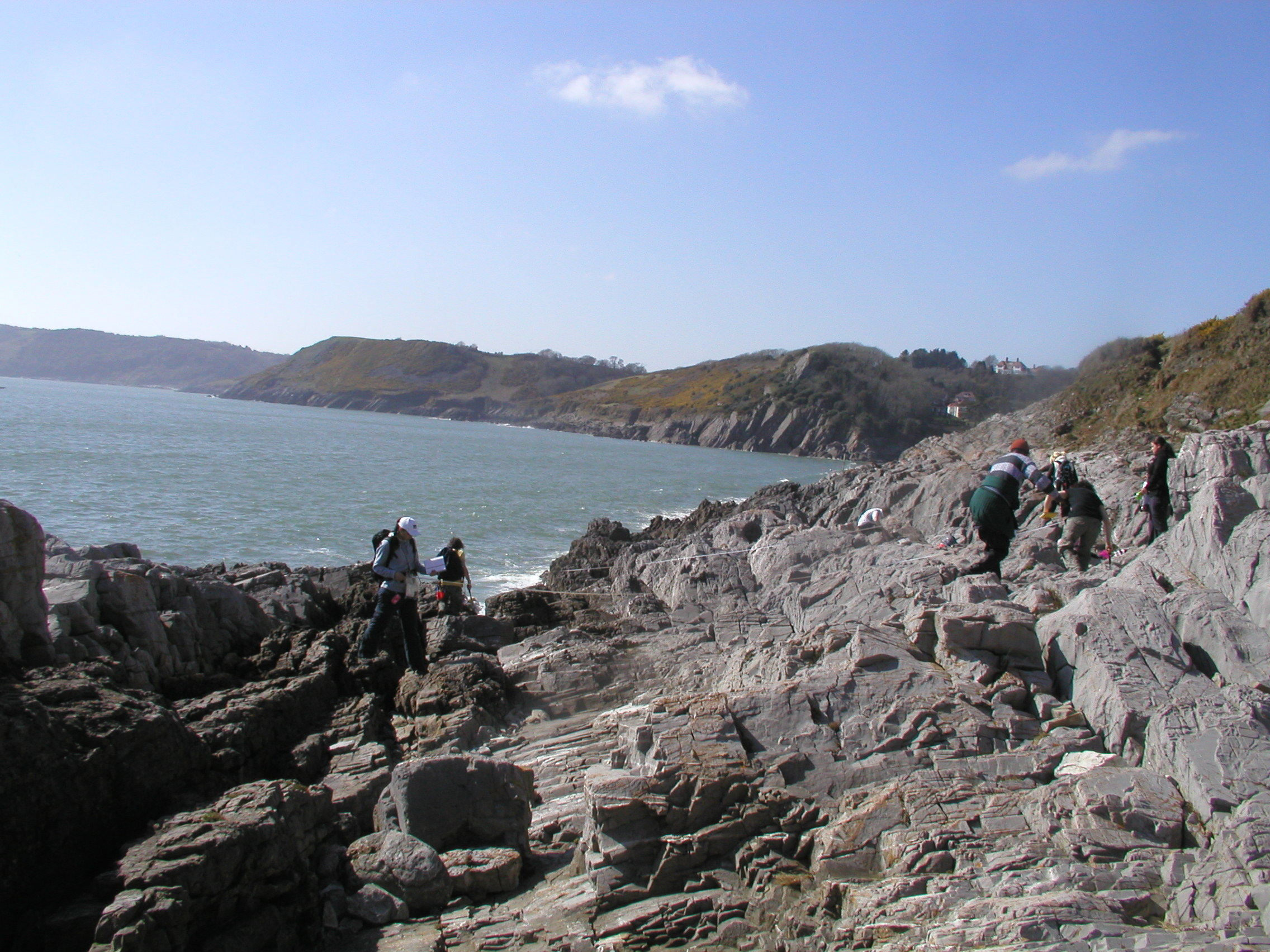
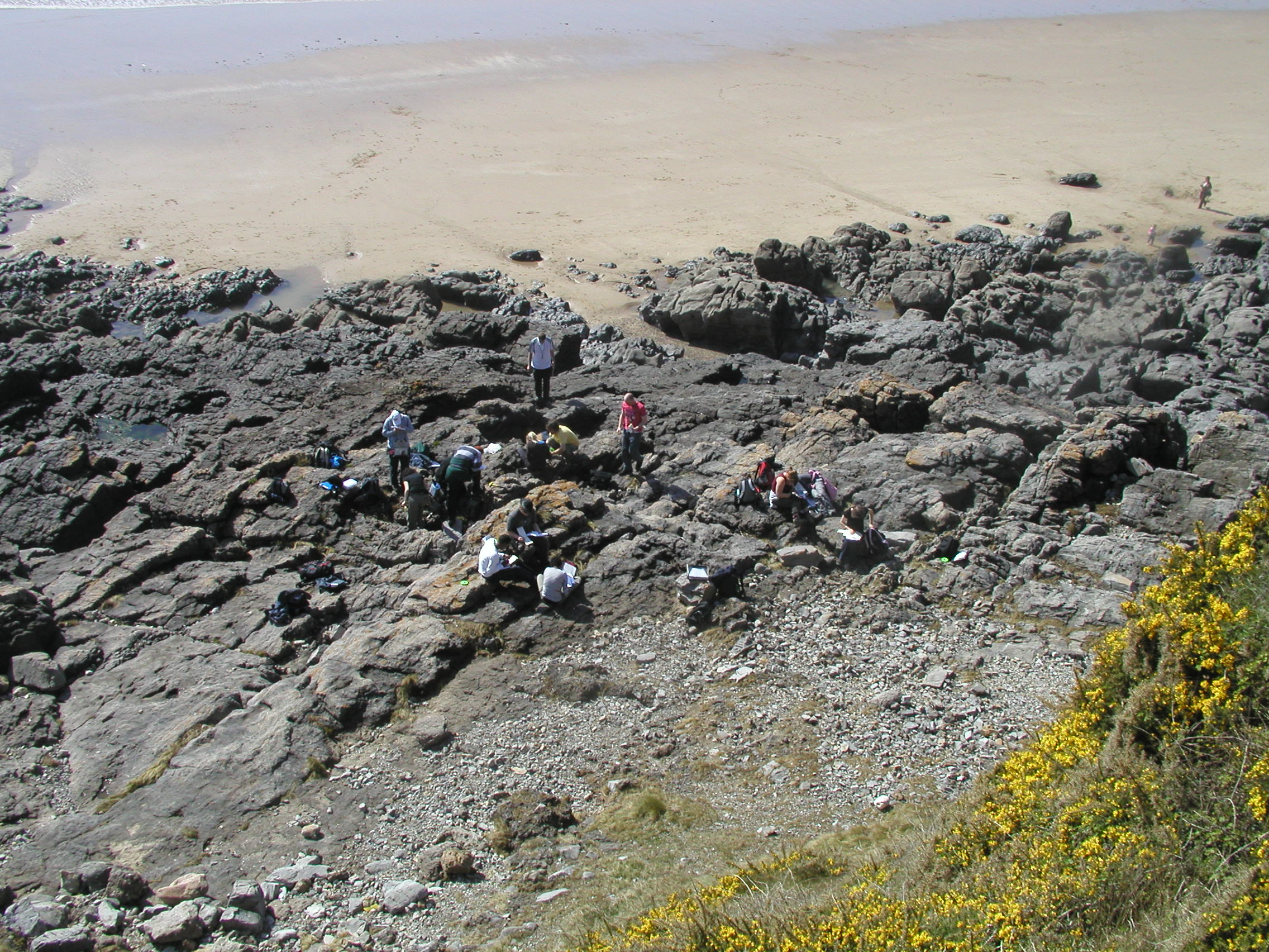
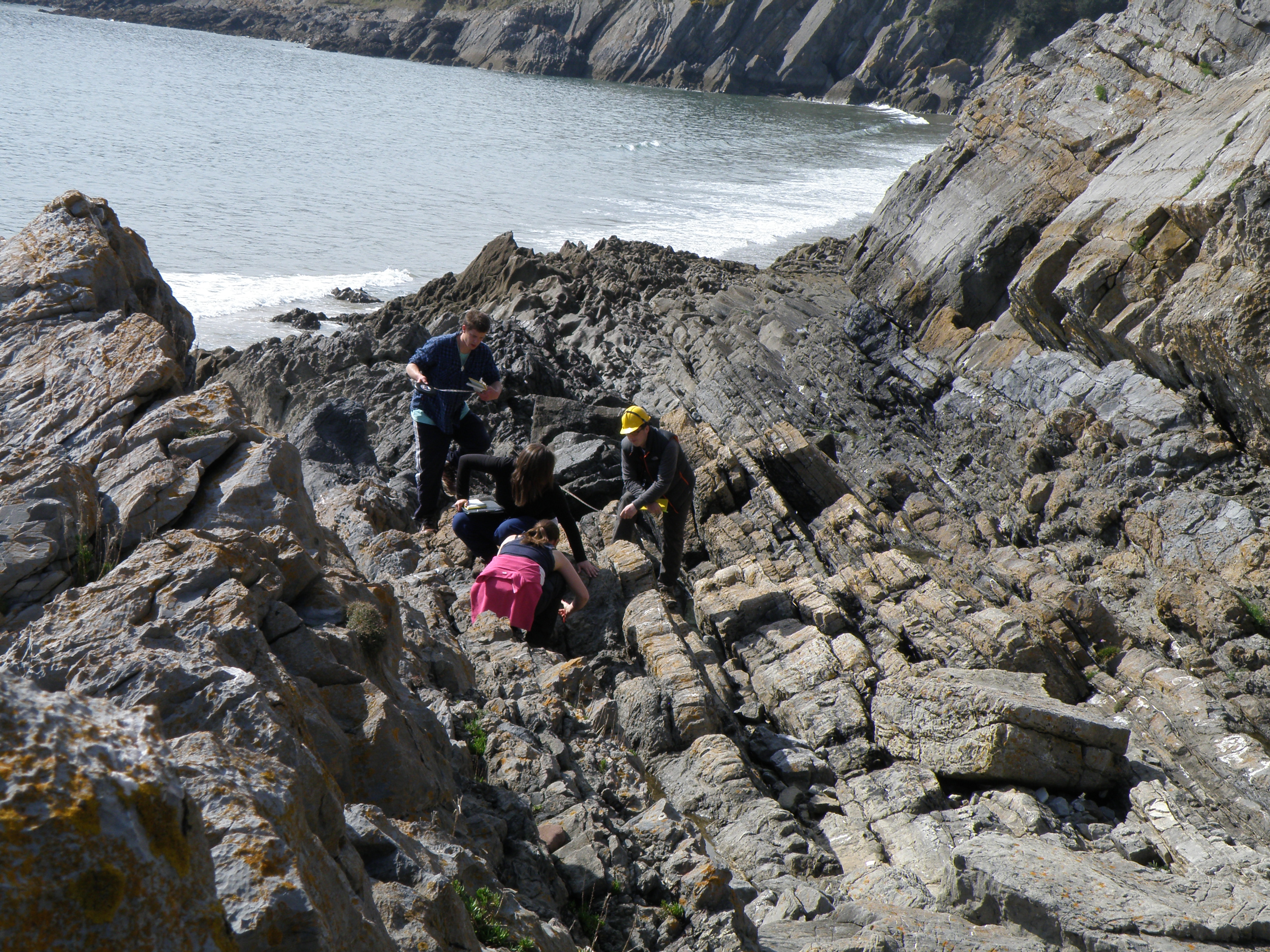
There's a lot of interesting, detailed
geology here, especially for limestone fans, and we usually spend 3-4 hours
logging this section and admiring the view.
As always, the aim of this exercise is to synthesize information of a variety of different types - for example lithology, thickness and geometry of sedimentary units, sedimentary structures and palaeocurrents, fossils and trace fossils (or absence thereof), lateral and vertical changes etc. From these observations, presented on your log, you should be able to attempt interpretations of the the processes, conditions and environments involved in the formation of the various units.
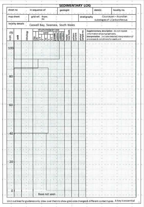 |
The Caswell Bay log. A higher resolution version is provided in the Base Maps file for you to complete your log. |
![]()
We last saw the Black Rock Limestone (BRL) at the top of the section at Skrinkle Haven, above the Avon Group. The upper part of it is exposed here, but we don't see the base in this section.
|
|
|
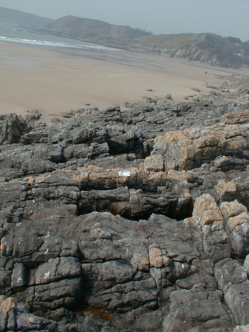
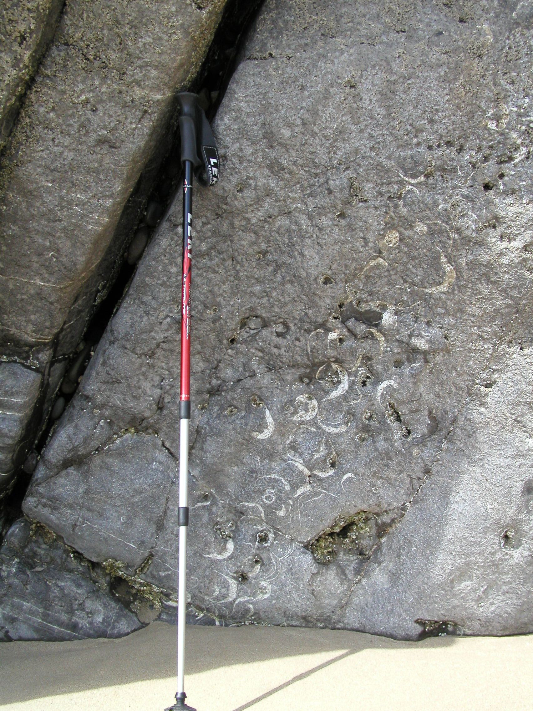
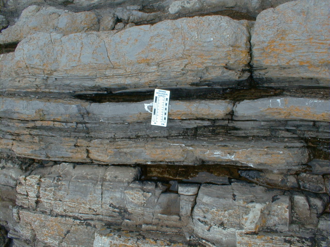
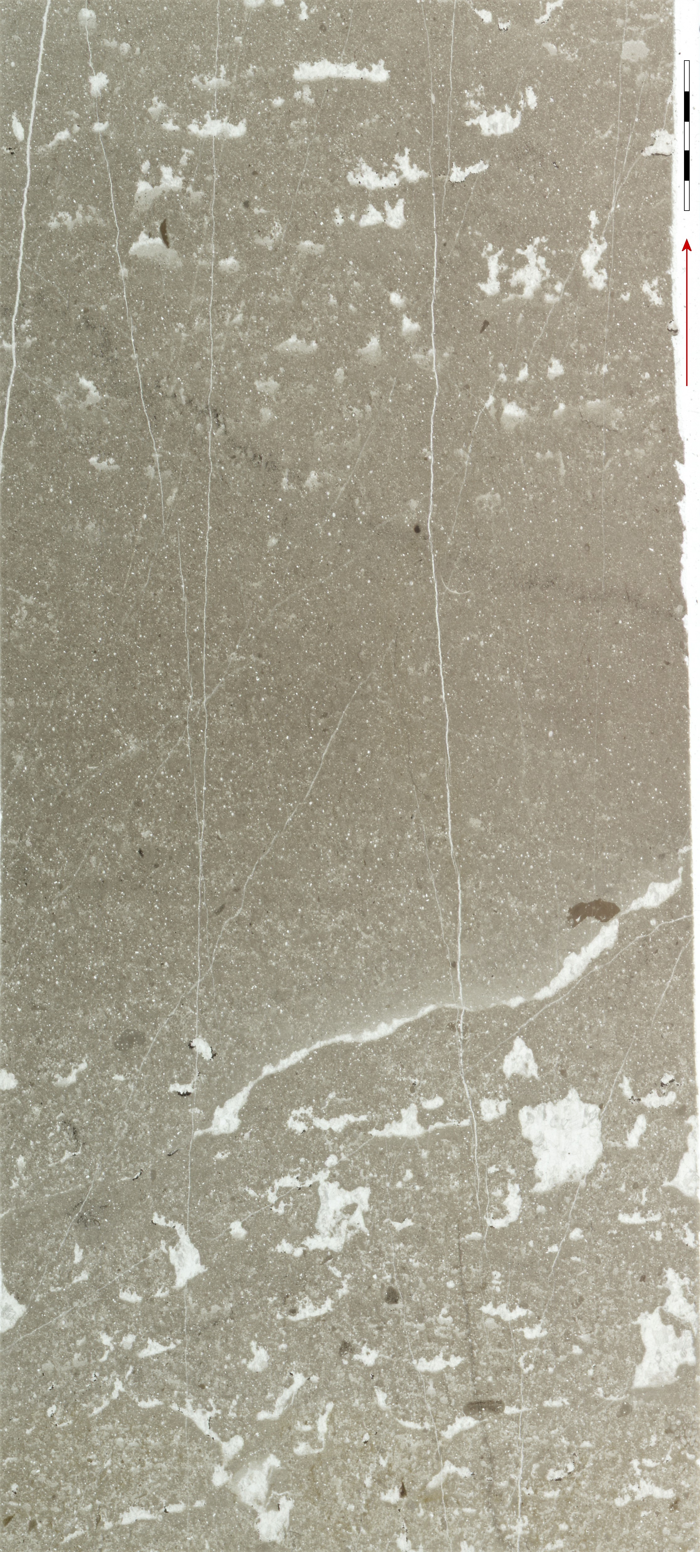
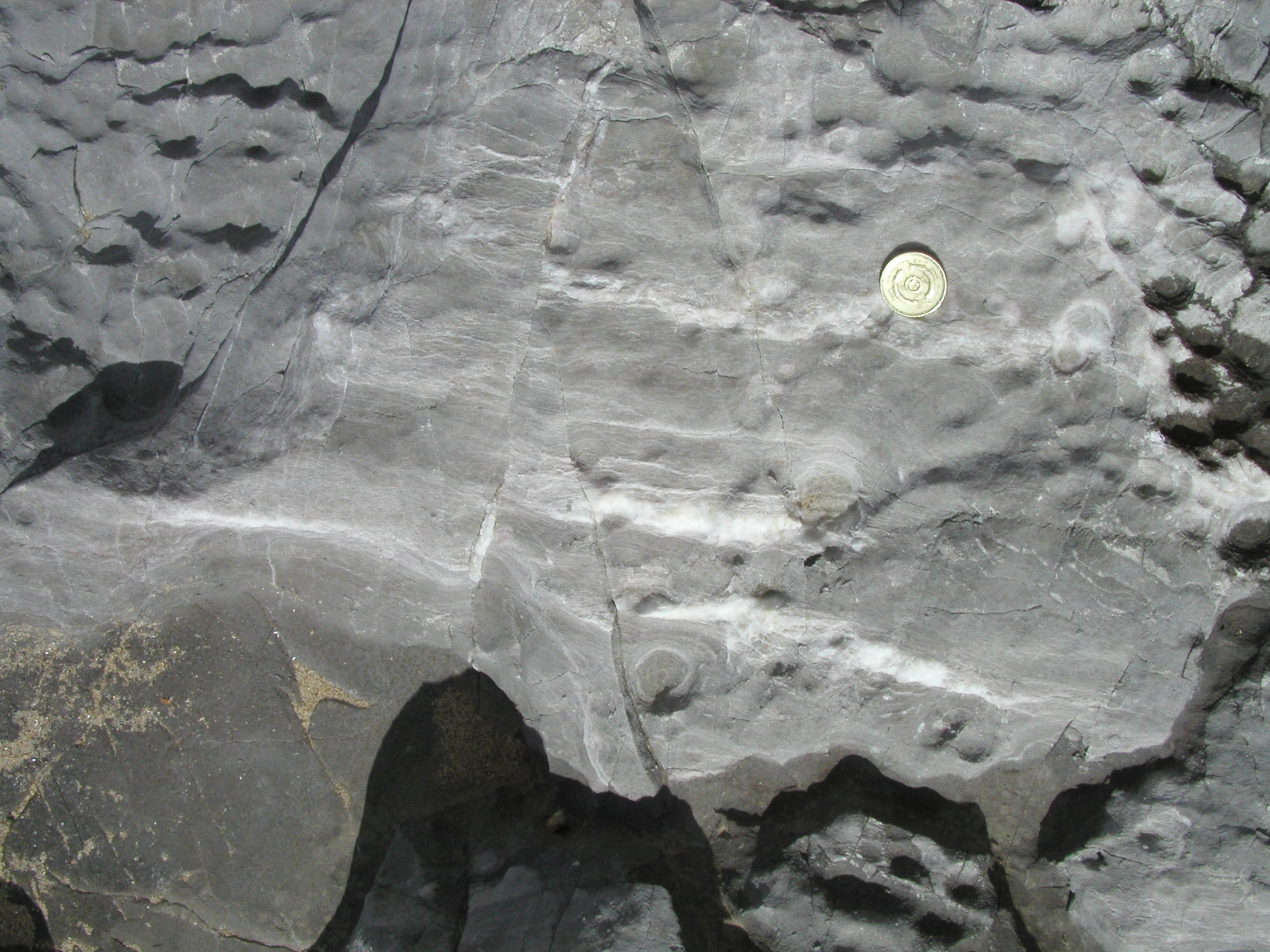
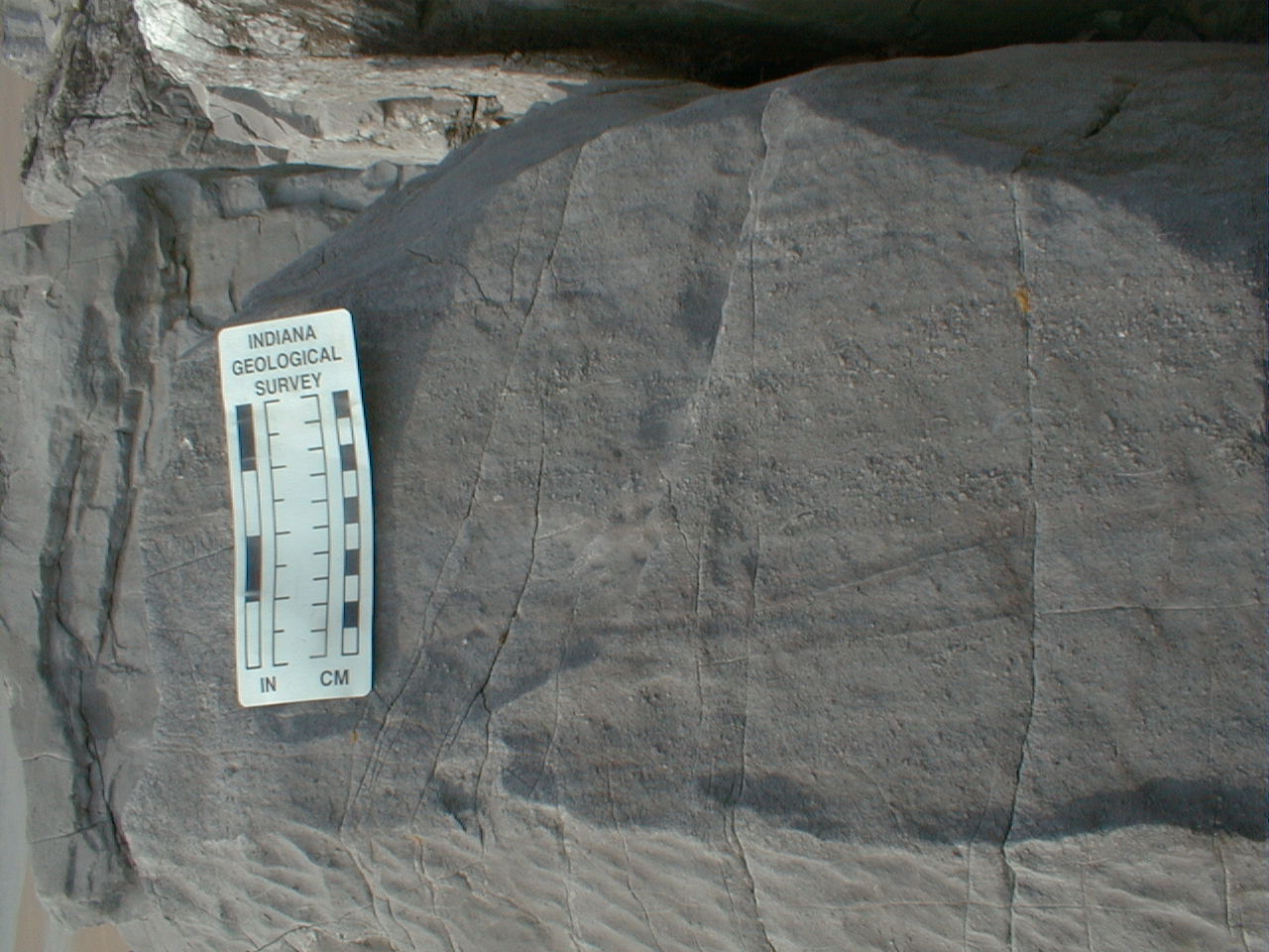
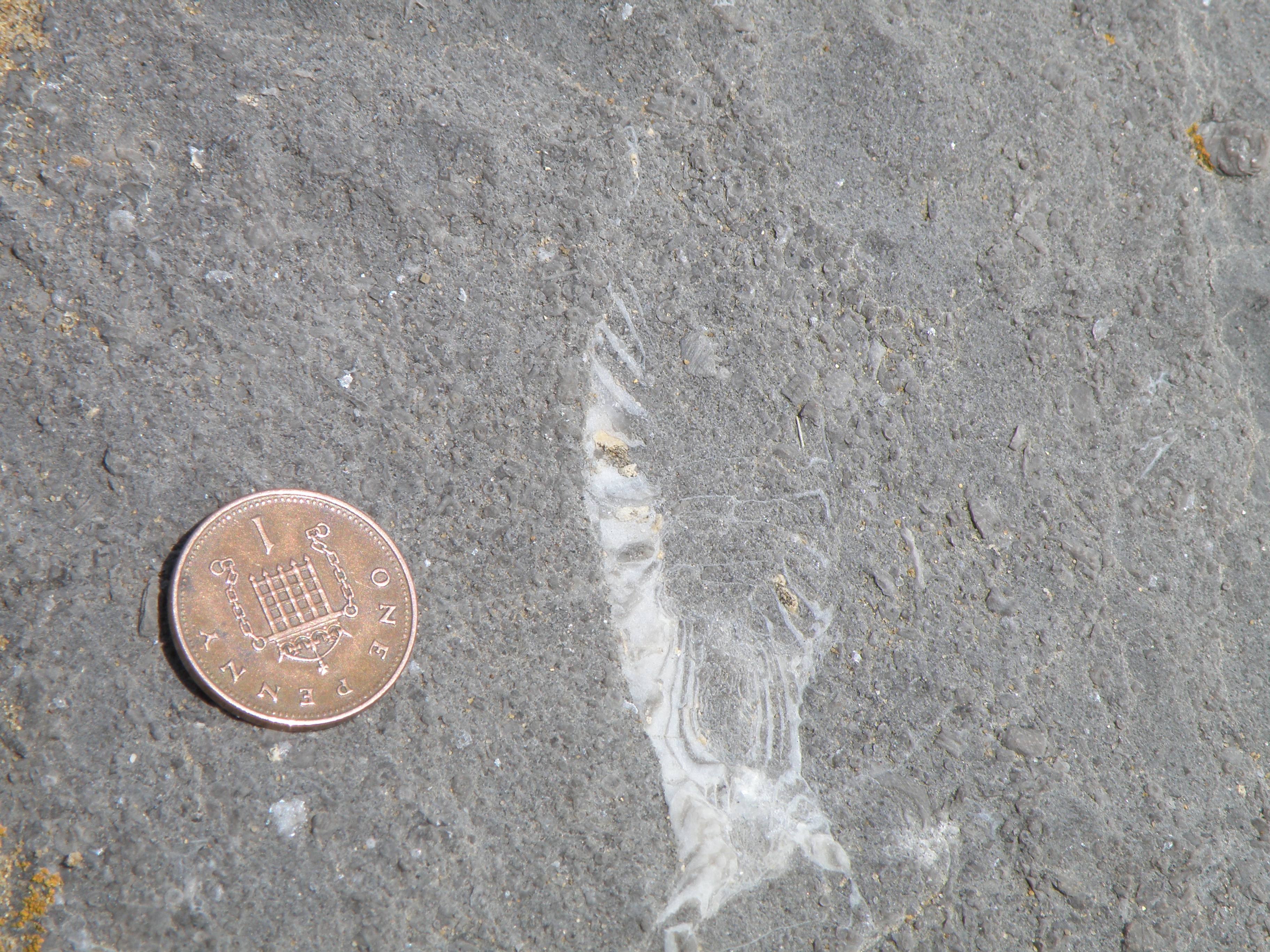
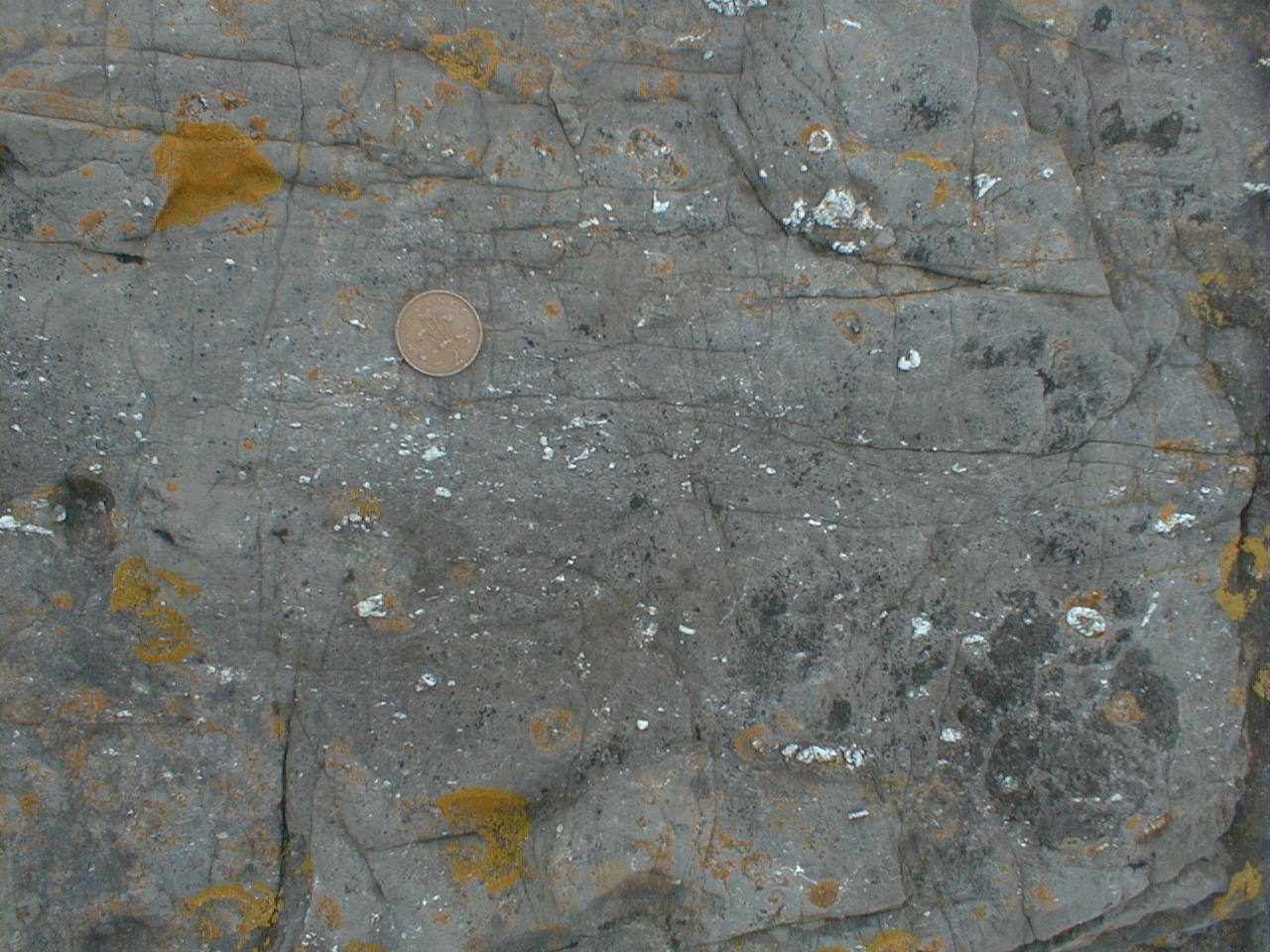 G3. BRL showing dark, muddy limestones with silicified fossils and irregular vugs filled by quartz (replacing calcite?) standing out on the weathered surface. Some parts of the limestones do not react readily with dilute HCl. |
 G4. Laminated fine muddy limestones and mudstones are interbedded with coarser more fossiliferous limestones. Vertical dip, younging towards top of photo. |
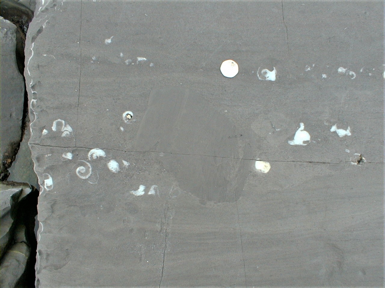
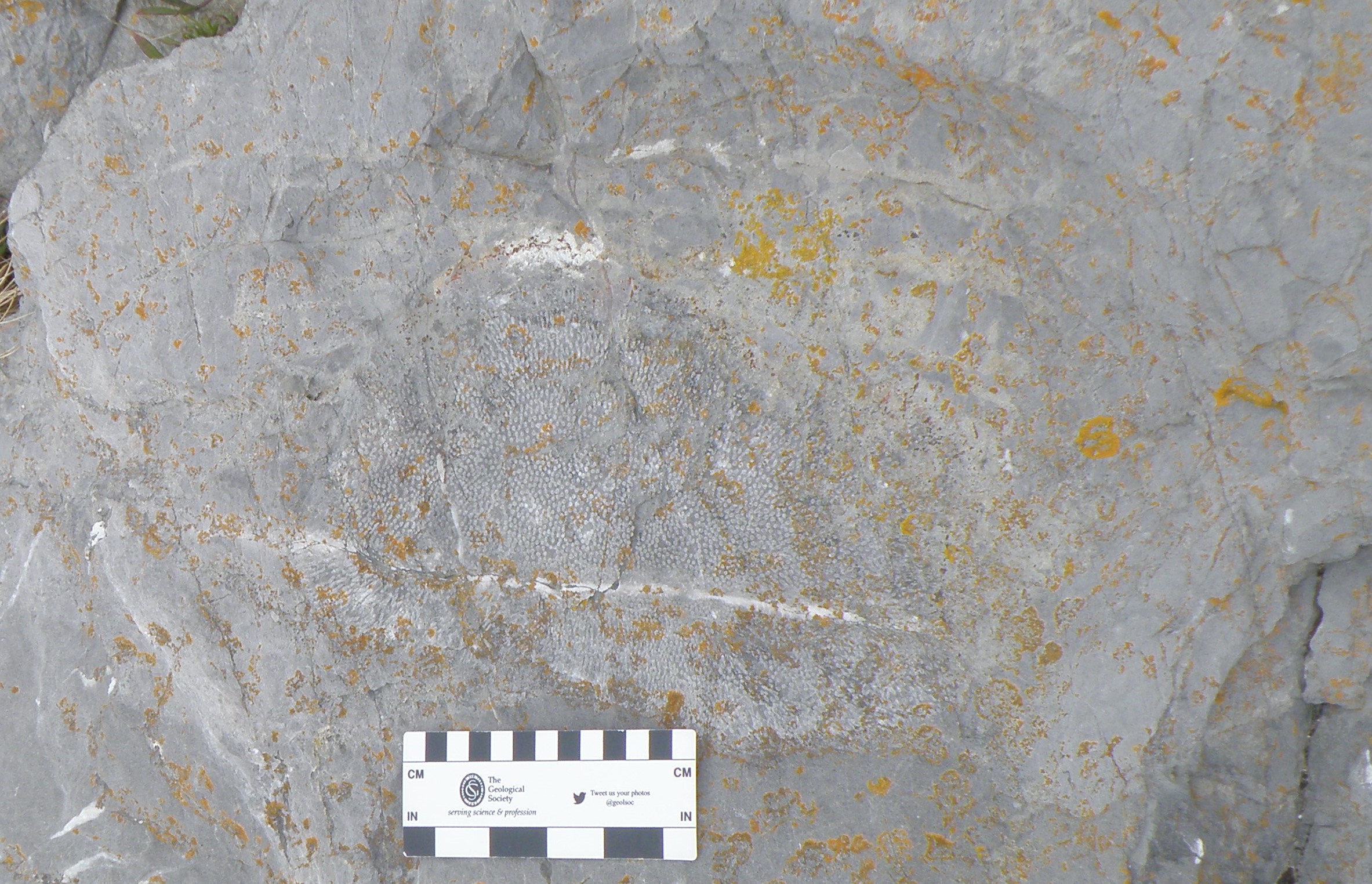
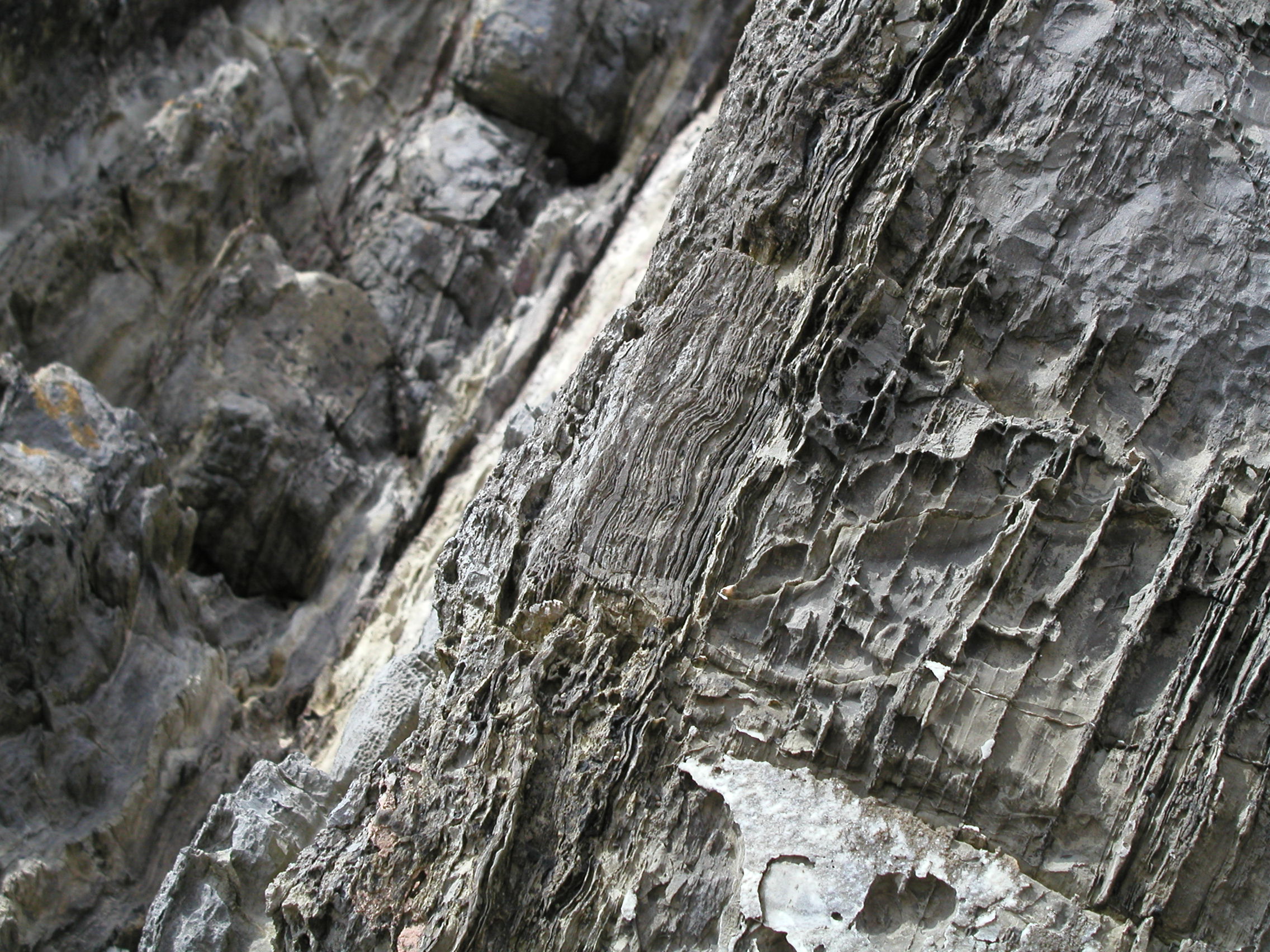
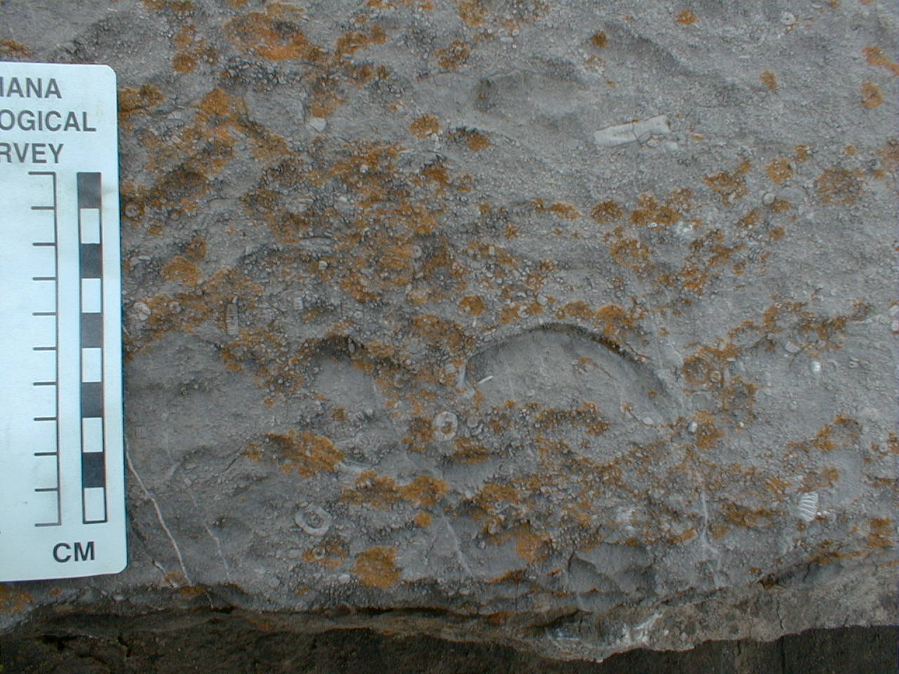
 G5. Identify the fossils in this muddy, poorly sorted limestone. Comment on their preservation. What do they tell us about conditions of deposition? |
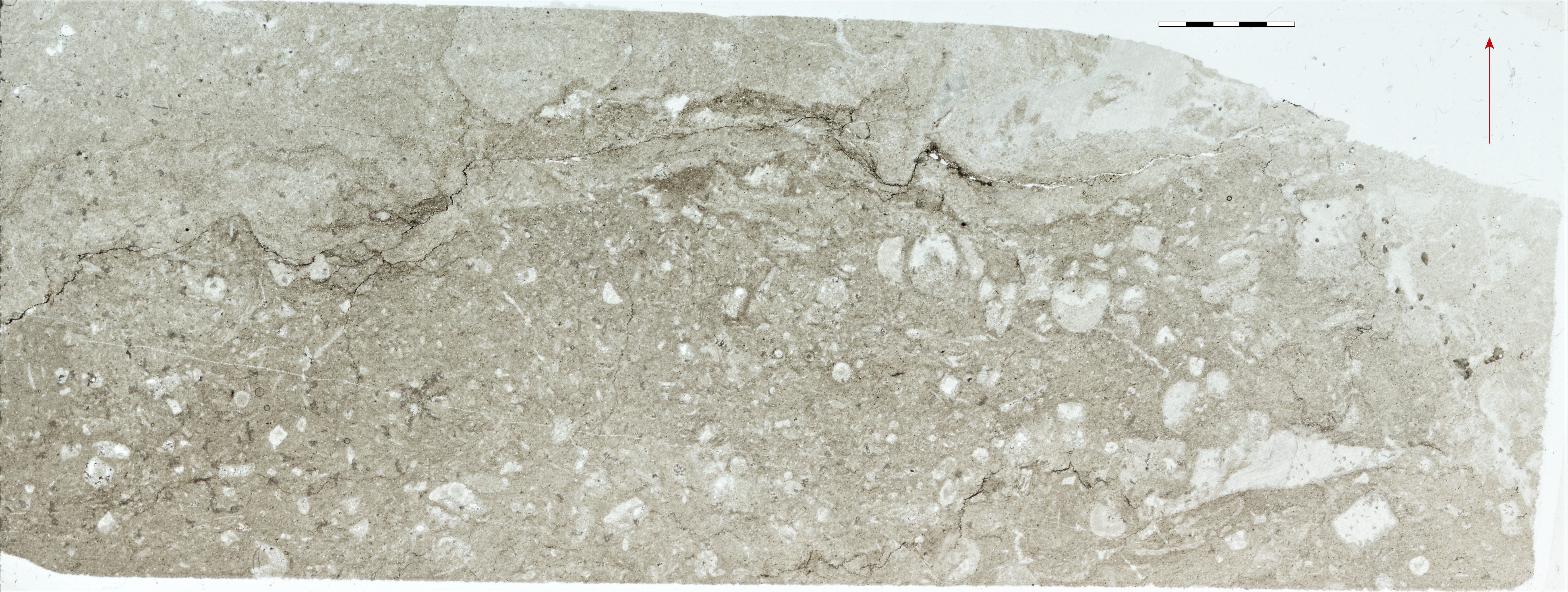
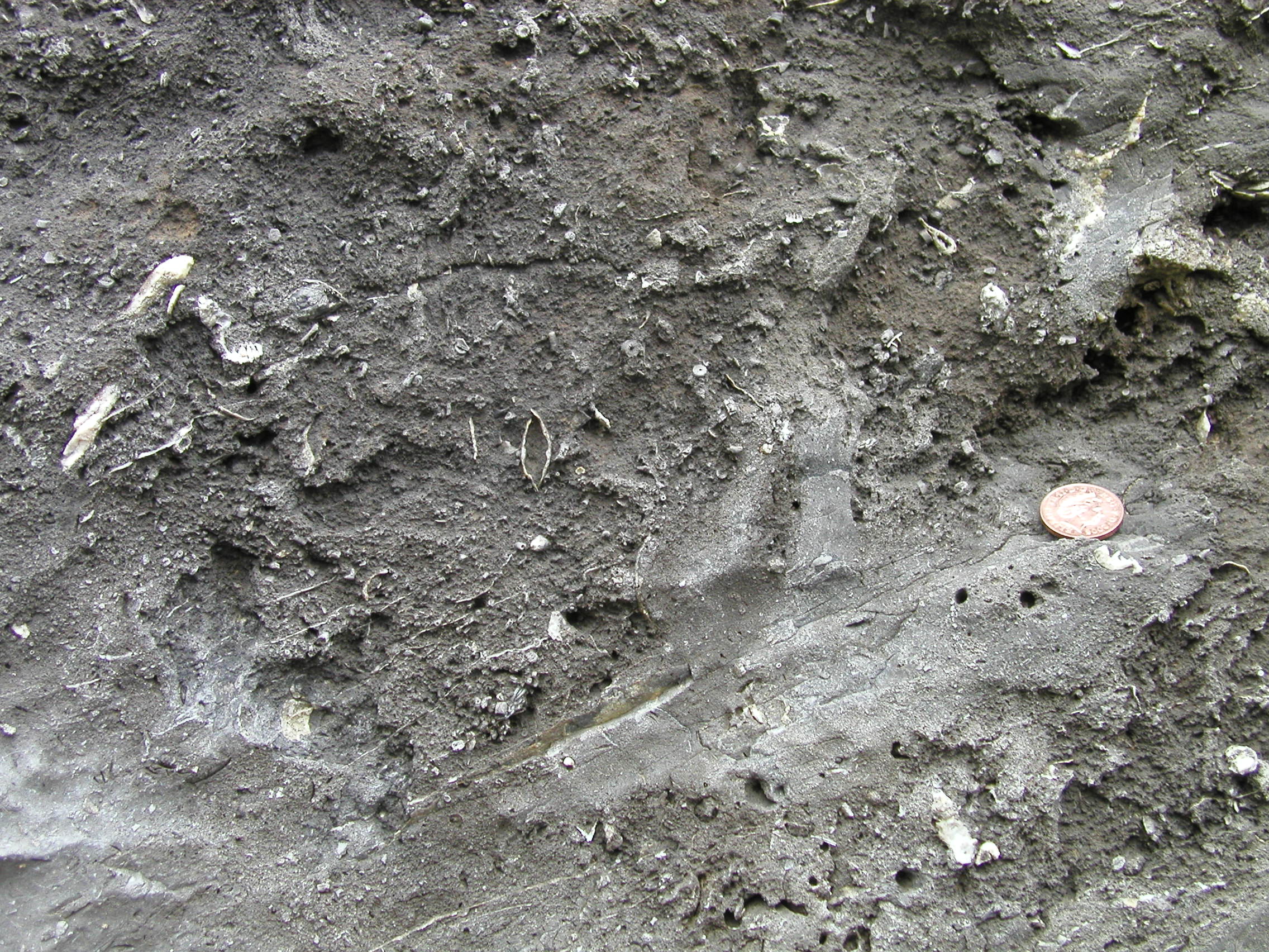 G6. Describe the rock, using the hand specimen description scheme, and identify the fossils. |
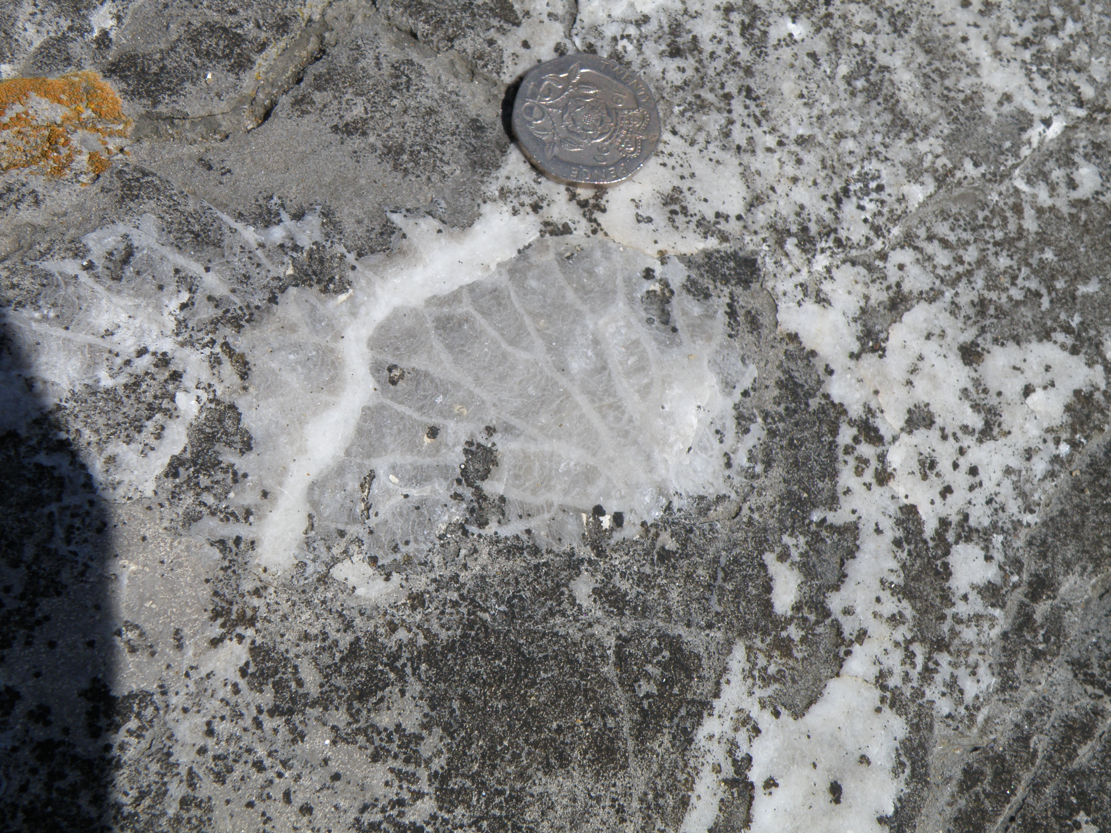
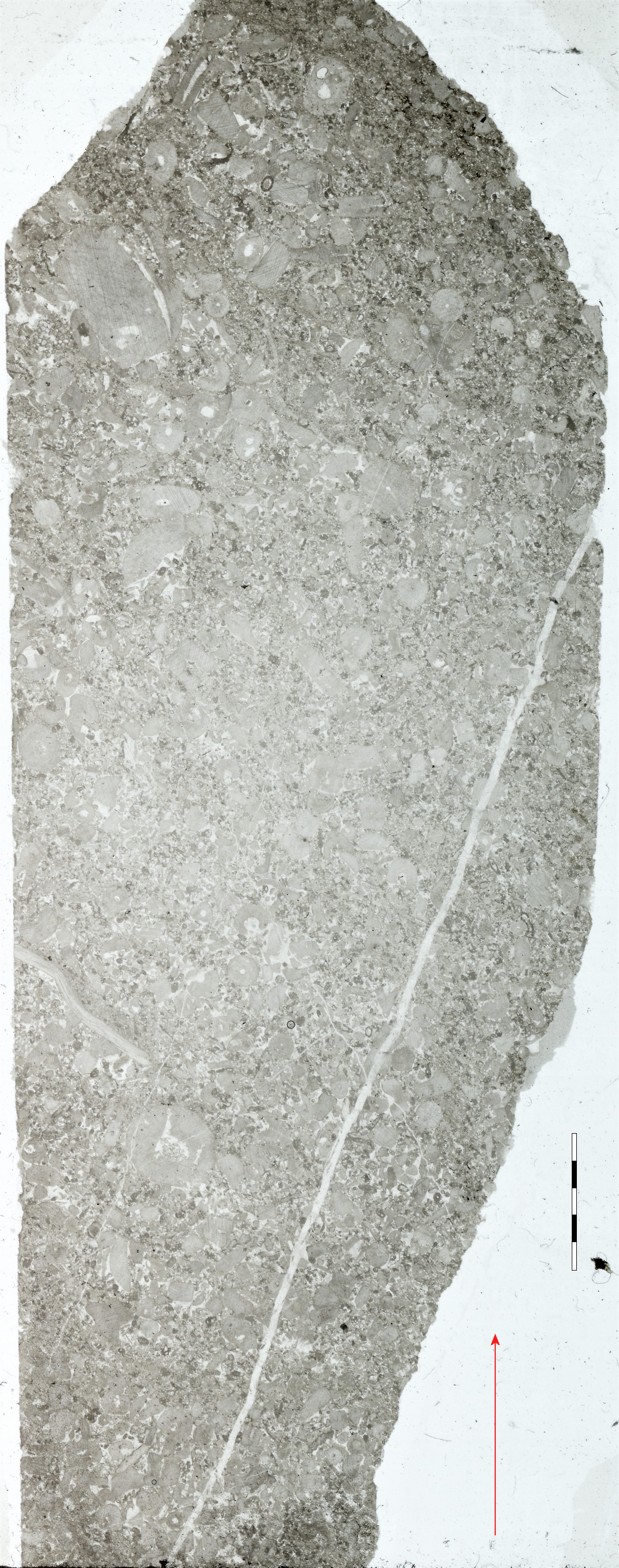
Describe the rock. What is the main bioclastic component? What are the highly irregular thin dark features crossing the slide, and what process do they represent? |
|
![]()
To study this formation in detail,
we are going to take two short, interactive virtual field trips. Each consists
of 6 images, from broad scale views down to microscope views. Proceed through
the field trip using the arrows. The ![]() icon will load a higher magnification view of the image; the
icon will load a higher magnification view of the image; the ![]() icon will take you back to the home page. Study the images and answer the interactive
questions. Make notes and images in your virtual notebook as you go through
the trips.
icon will take you back to the home page. Study the images and answer the interactive
questions. Make notes and images in your virtual notebook as you go through
the trips.
Additional images and information from the Caswell Bay Oolite (CBO):
|
|
|
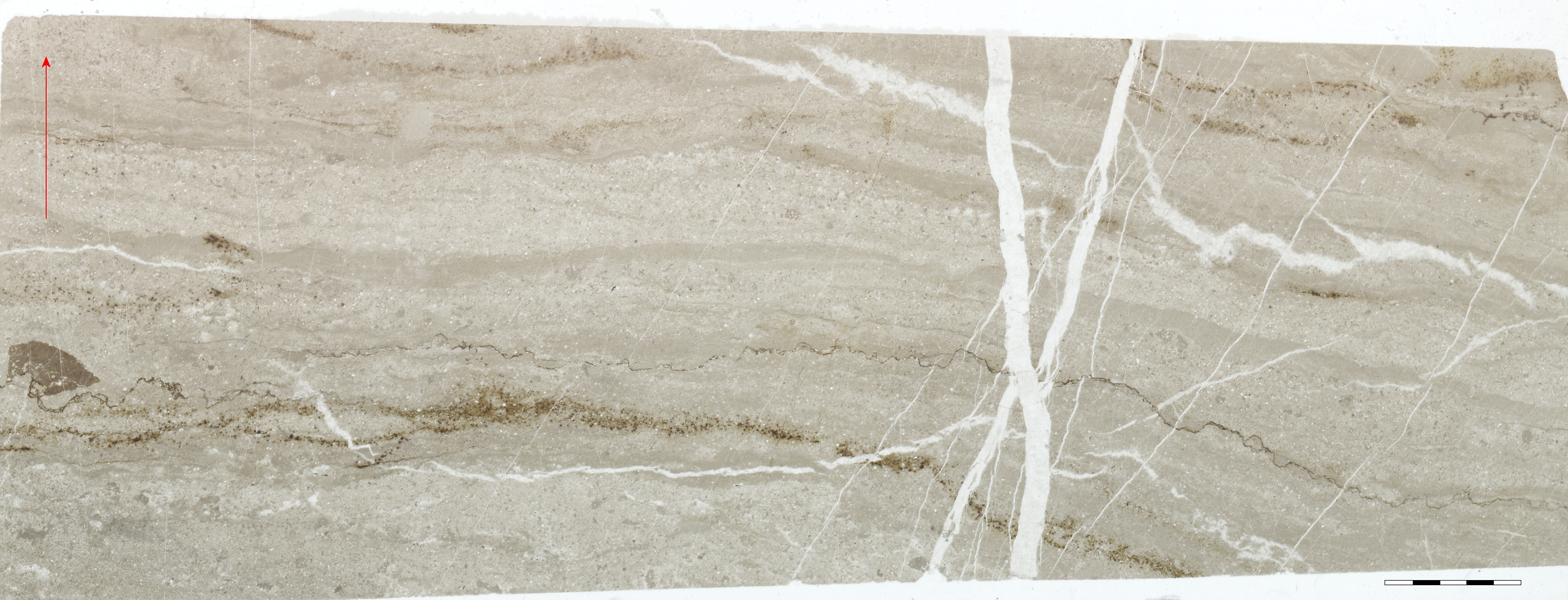
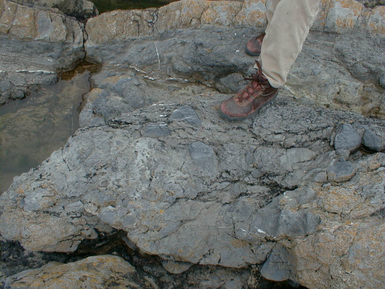
 H3. Bedded CBO. What are the coarser components likely to be? |
 H4. Identify these structures. What do they tell us about sediment transport? |
|
Describe the contact. Identify the components of the coarse bed. What structures are present in the bedded oolite below? |
What is the main fossil component? |
Identify it as accurately as possible, and comment on the sedimentary processes involved. |
Identify it as accurately as possible, and comment on the sedimentary processes involved. |
![]()
This unit is quite different from any other limestones in this section. Some of the beds do not react with acid, suggesting they are dolomitized. Macrofossils are largely absent from these beds, unlike other units in the logged section. What might this tell us about environmental conditions?
|
|
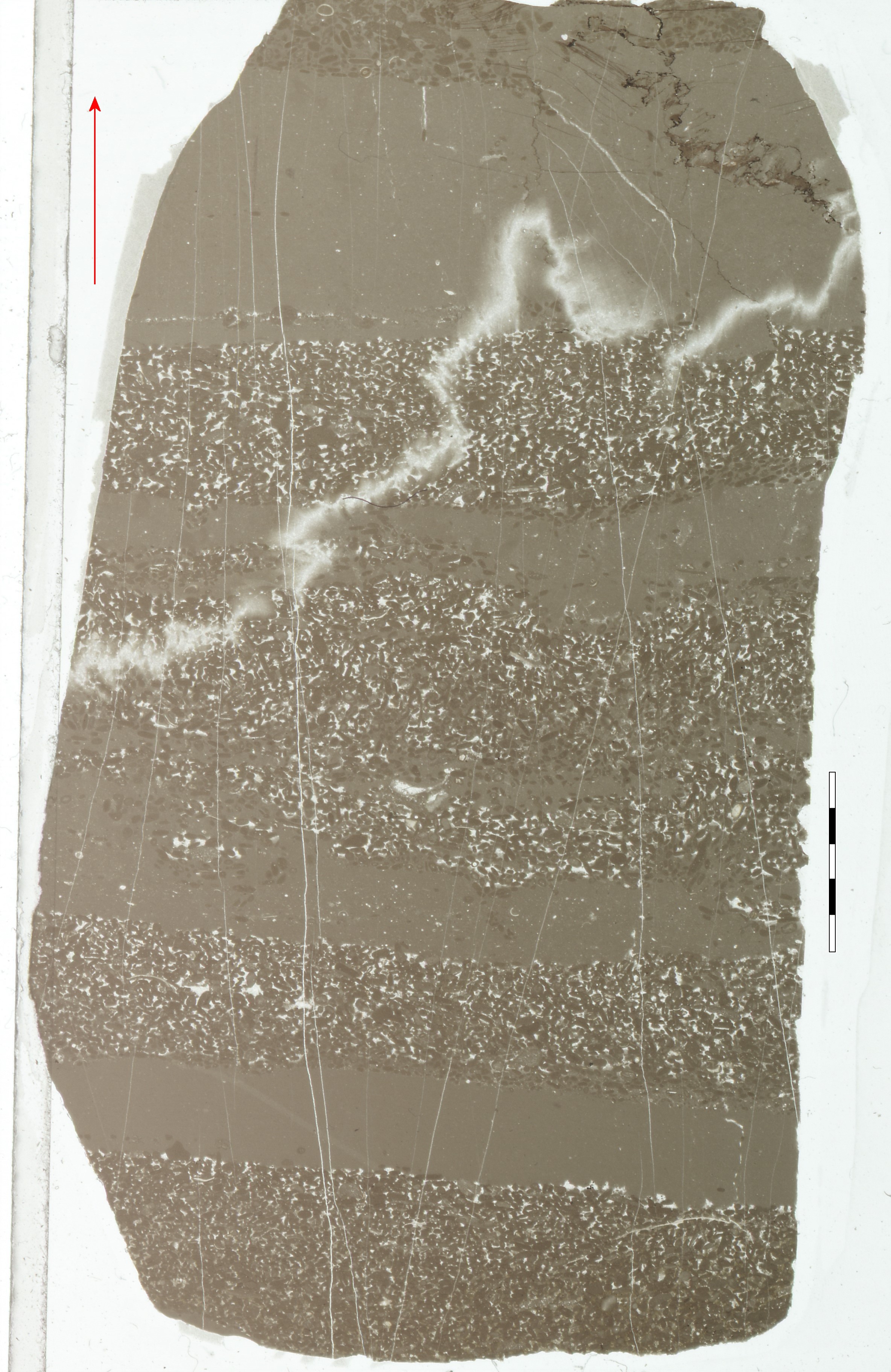
 J2. The discontinuous basal unit of the CBM - this rock infills hollows in the irregular top of the underlying CBO. Above this coarse rock, laminated limestones are seen at the top of the photo. |
 J3. Laminated micritic limestones of the CBM. |
Look carefully at the laminations in this photo and J3. |
|
Try to account for the nature and origin of the laminations in this micritic limestone. |
Describe the depositional and diagenetic features you can see. |
Describe the two lithologies. What are the grains in the coarser laminae? |
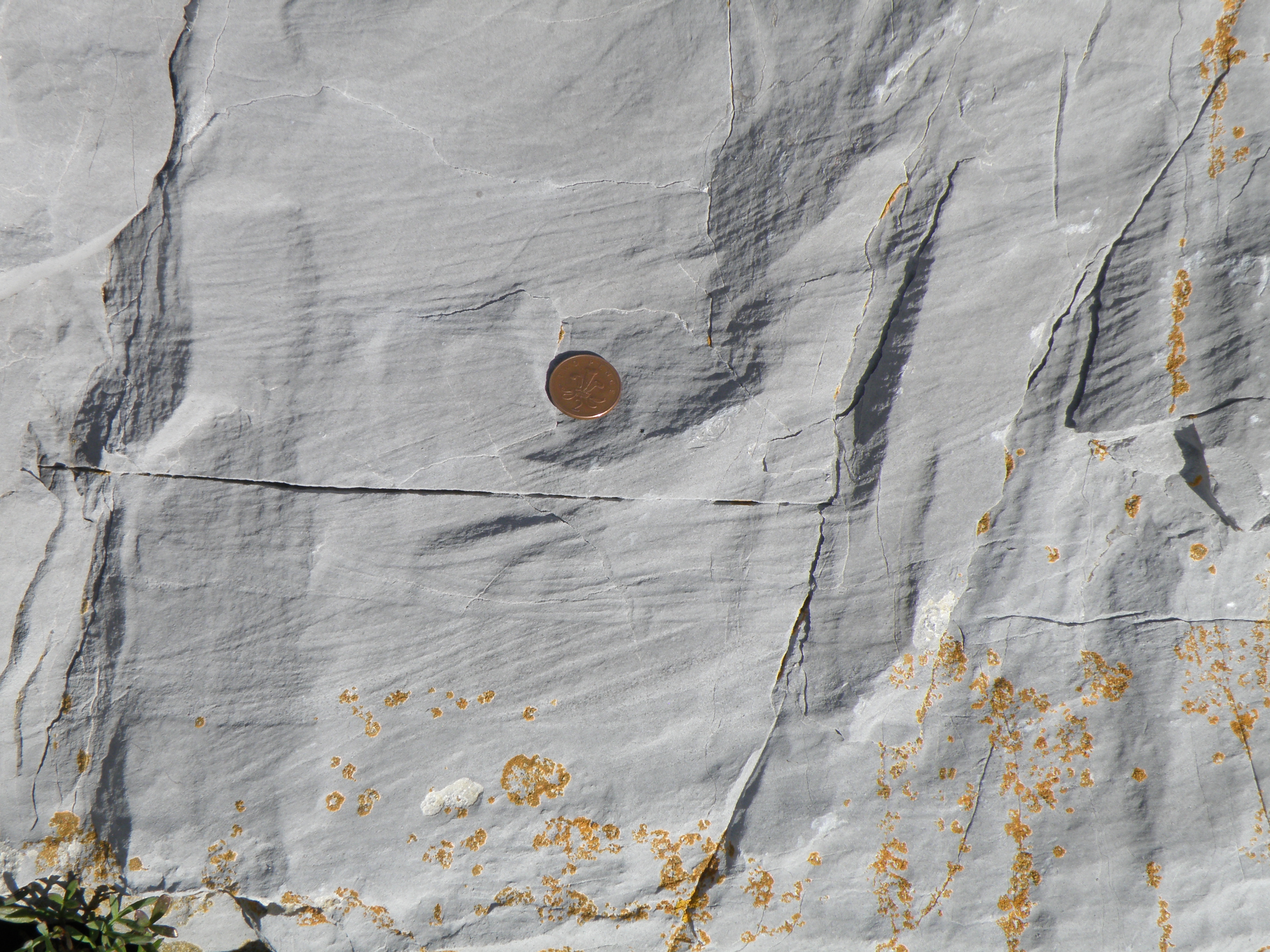
What are the light-coloured
features in this micritic limestone? How and when did they form? |
![]()
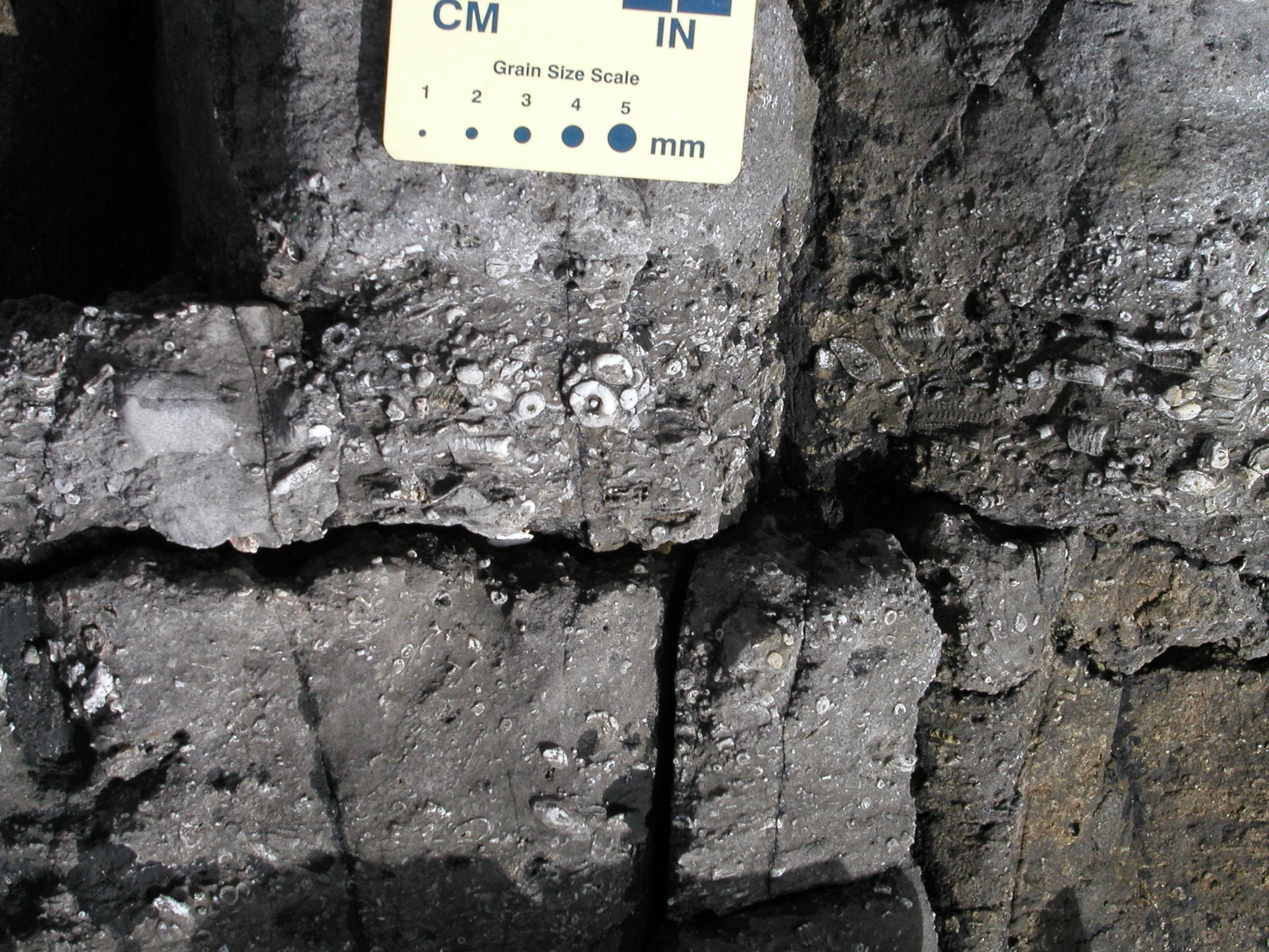
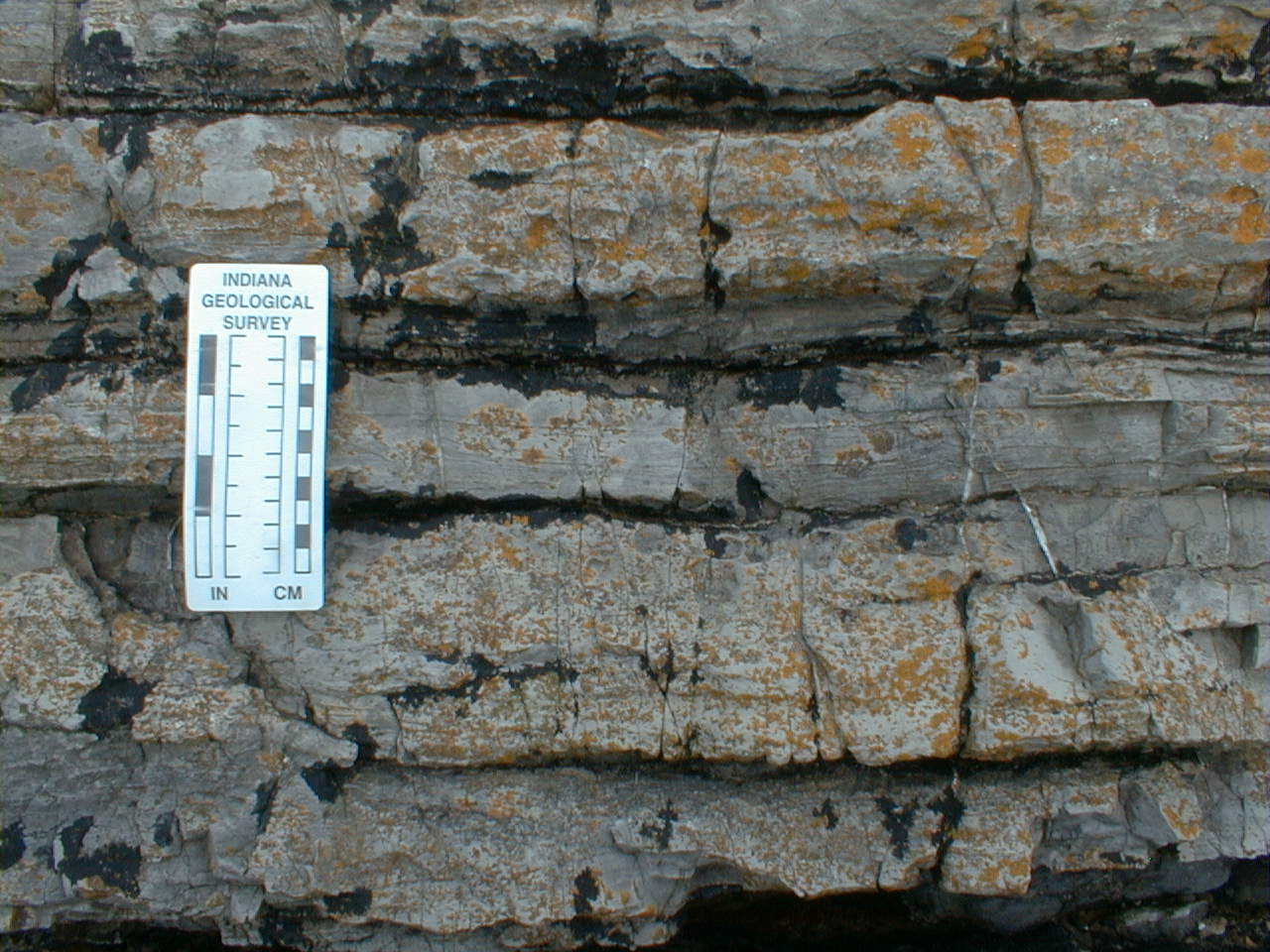
In this rather coarse-grained unit, macrofossils again become abundant. All beds react reasily with dilute HCl.
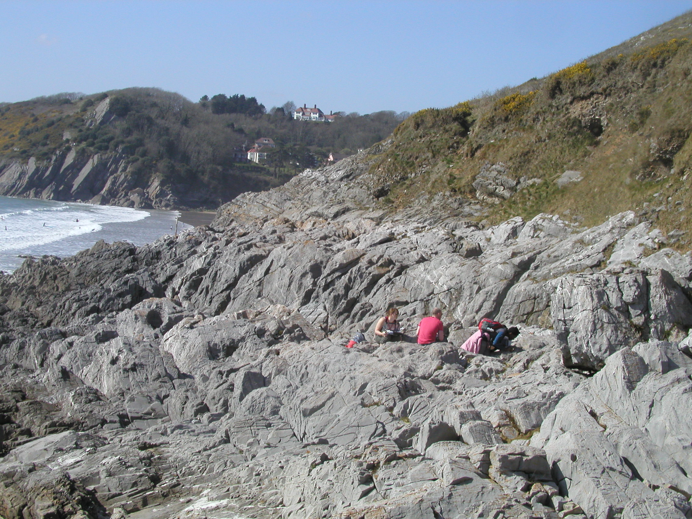
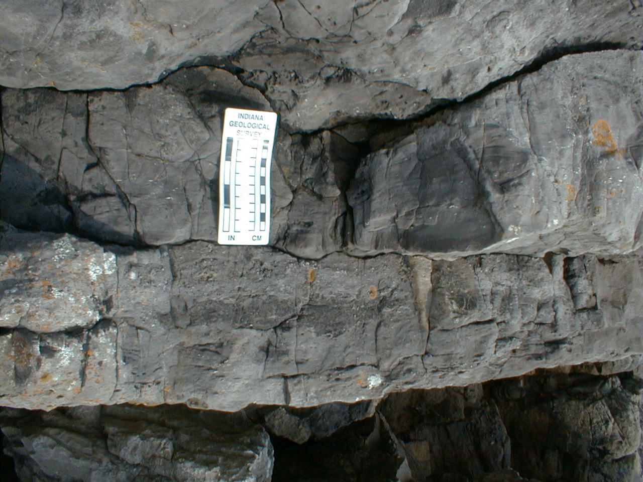
 K1. View of the Caswell Bay Mudstone Formation and its sharp, more or less planar contact with the overlying High Tor Limestone (HTL). The contact is in the narrow gap under the overhang. The dip is now less steep, still to the north. |
Give as full a description as possible, using the hand specimen scheme. Identify the fossils present. |
 K3. Comment on the grain size, sorting and fossil content of this limestone, in the bed above K2. |
What additional information can you obtain from this view? |
Interpreting the field evidence
You have now acquired a variety of different types of data on the sedimentary sequence shown in the log. This includes lithology, sedimentary structures, fossils and field relationships seen in photographs and samples. Once you have completed your log, your task is to interpret the data.
I recently discovered the Welsh composer Grace Williams on the radio. She was born in Barry, our next location. Listen to some of her music and see what you think - perhaps start with Hiraeth. If you like this, check out her YouTube channel.
Since we're in Glamorgan, today's recipe is for Glamorgan sausages - possibly the world's first vegetarian sausages, made with cheese and leeks. This recipe is from the Hairy Bikers.
![]()
Make sure you've completed all the work for this locality. Now we can get back on the virtual coach and head off to our next stop at Barry Island
![]()
This page is maintained by Roger Suthren. Last updated 13 January, 2021 12:08 PM . All images © Roger Suthren unless otherwise stated. Images may be re-used for non-commercial purposes.