It is important that you access this field trip on a laptop or desktop PC. Click on any image to enlarge it.
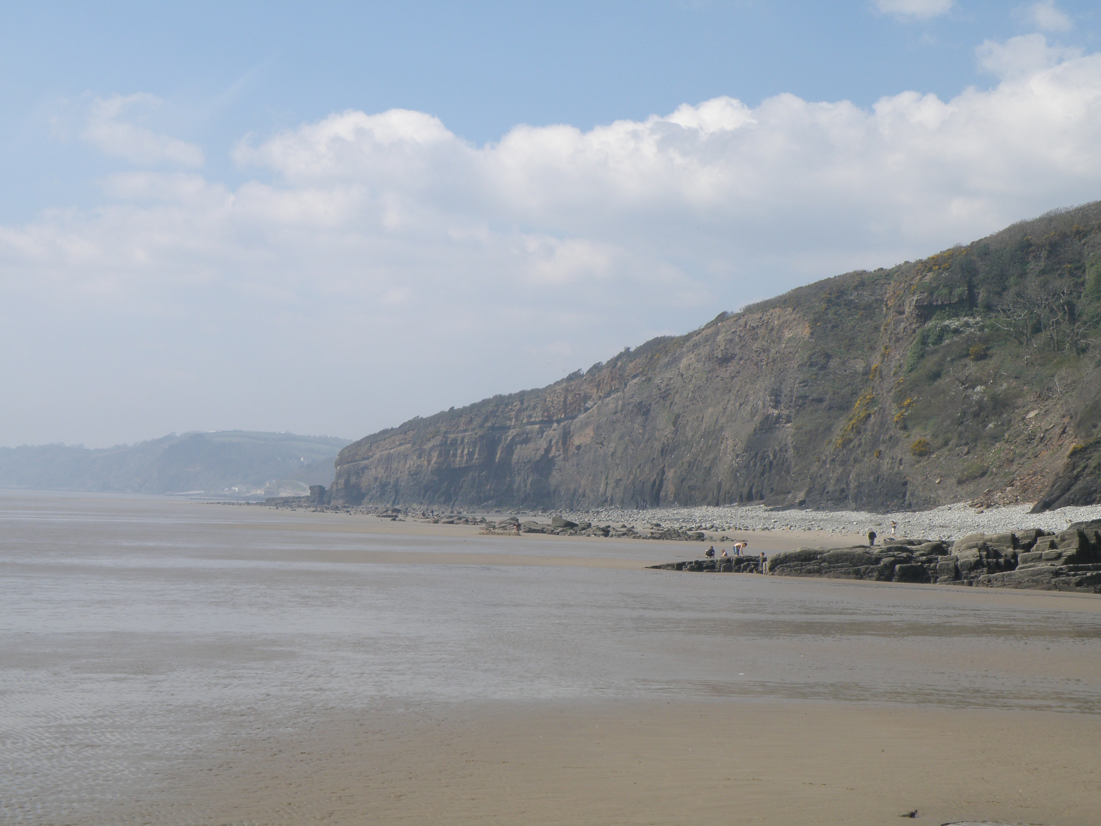
In this excursion, we will be traversing the coast westwards from SW Carmarthenshire into SE Pembrokeshire. Our traverse starts at the west end of Marros Sands, and finishes at Telpyn Beach, east of the village of Amroth. Explore the area in Google Maps.
The aim at this location is to walk through an Upper Carboniferous sedimentary sequence, using a part-completed log, and to add detailed outcrop information to that log. As always, you should collect and synthesize information of a range of different types - lithology, thickness and geometry of sedimentary units, sedimentary structures and palaeocurrents, fossils and trace fossils (or absence thereof), lateral and vertical changes etc. From these observations, you should be able to attempt interpretations of the processes and environments involved in the formation of the section.
Handout: refer to the handout for today, which contains essential diagrams and information. Don't forget to use the information in the Field Guide too.
Tasks: See today's handout, and the photo captions and information below.
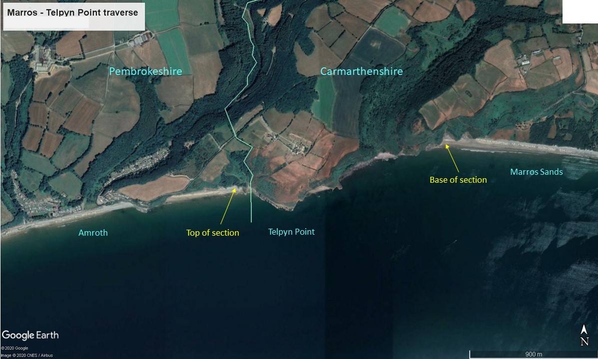
Google Earth map showing
the location of the section
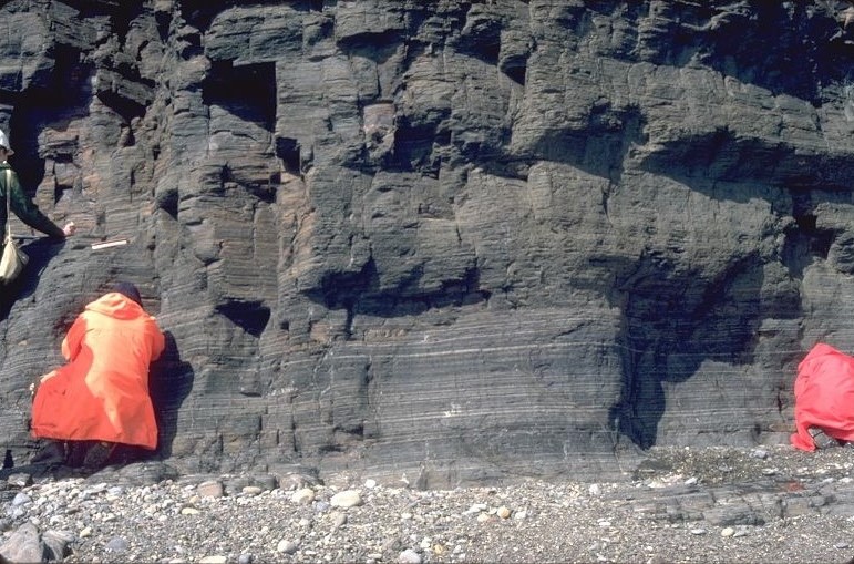
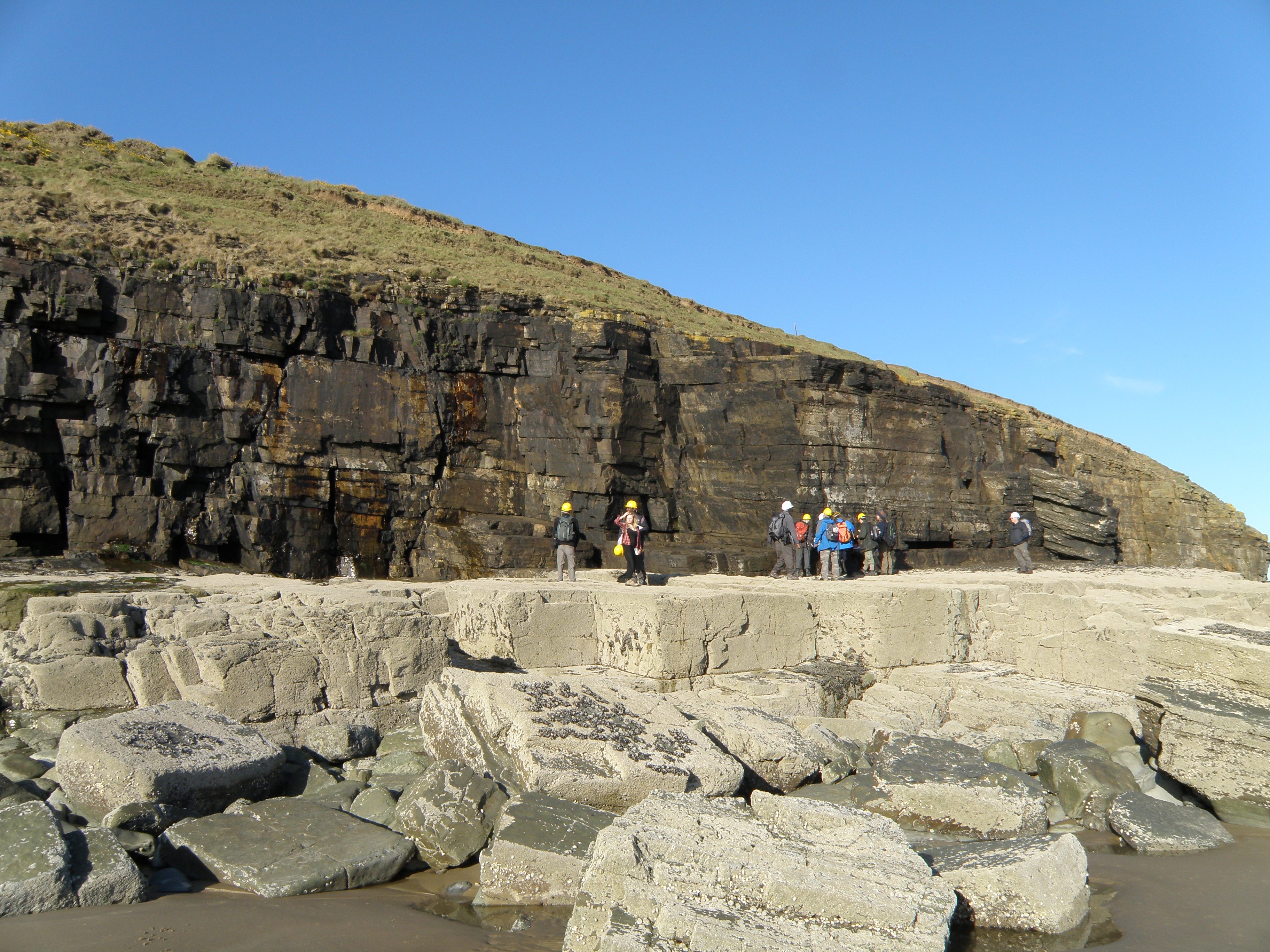
There is superb exposure in the cliffs and in the wave-cut foreshore. This section is very tide dependent, but we won't need to worry about that this year! There is complex Variscan compressional deformation, including thrusting, in the Palaeozoic rocks along this coast, but we have chosen a section with few structural complications, where the rocks are dipping gently to the west. So, as we traverse west along the foot of the cliffs, we move slowly up-section through rocks of Namurian (Upper Carboniferous) age. This section lies stratigraphically immediately below the section at Locality 4.1, Amroth East.
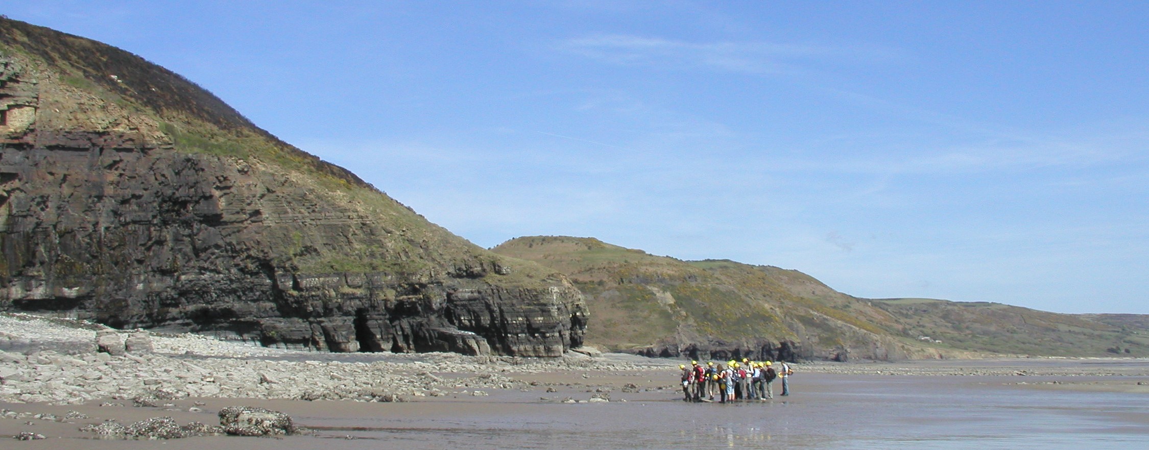
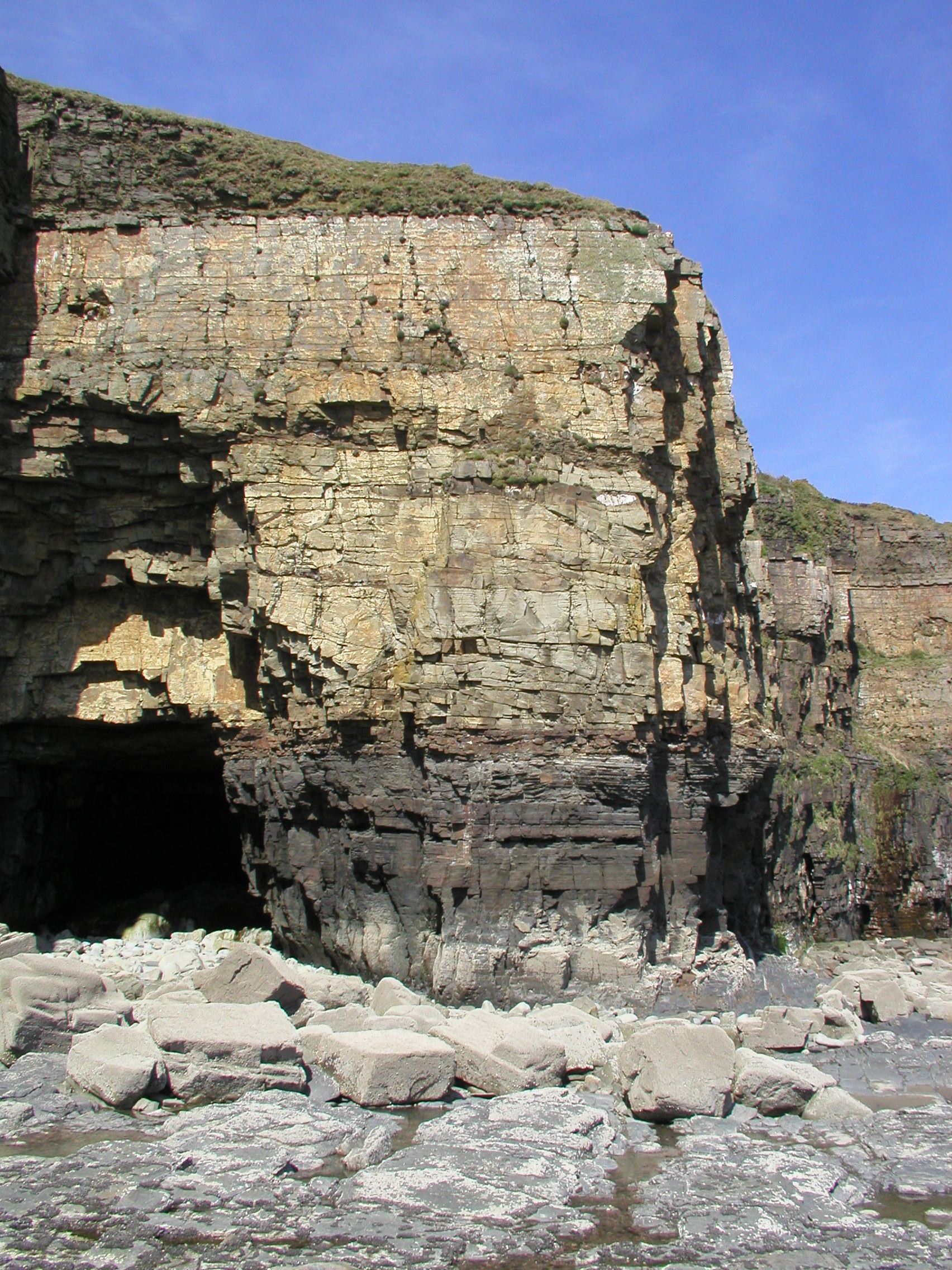
General view of the lower
part of the section. Marros Sands is to the right (east).
![]()
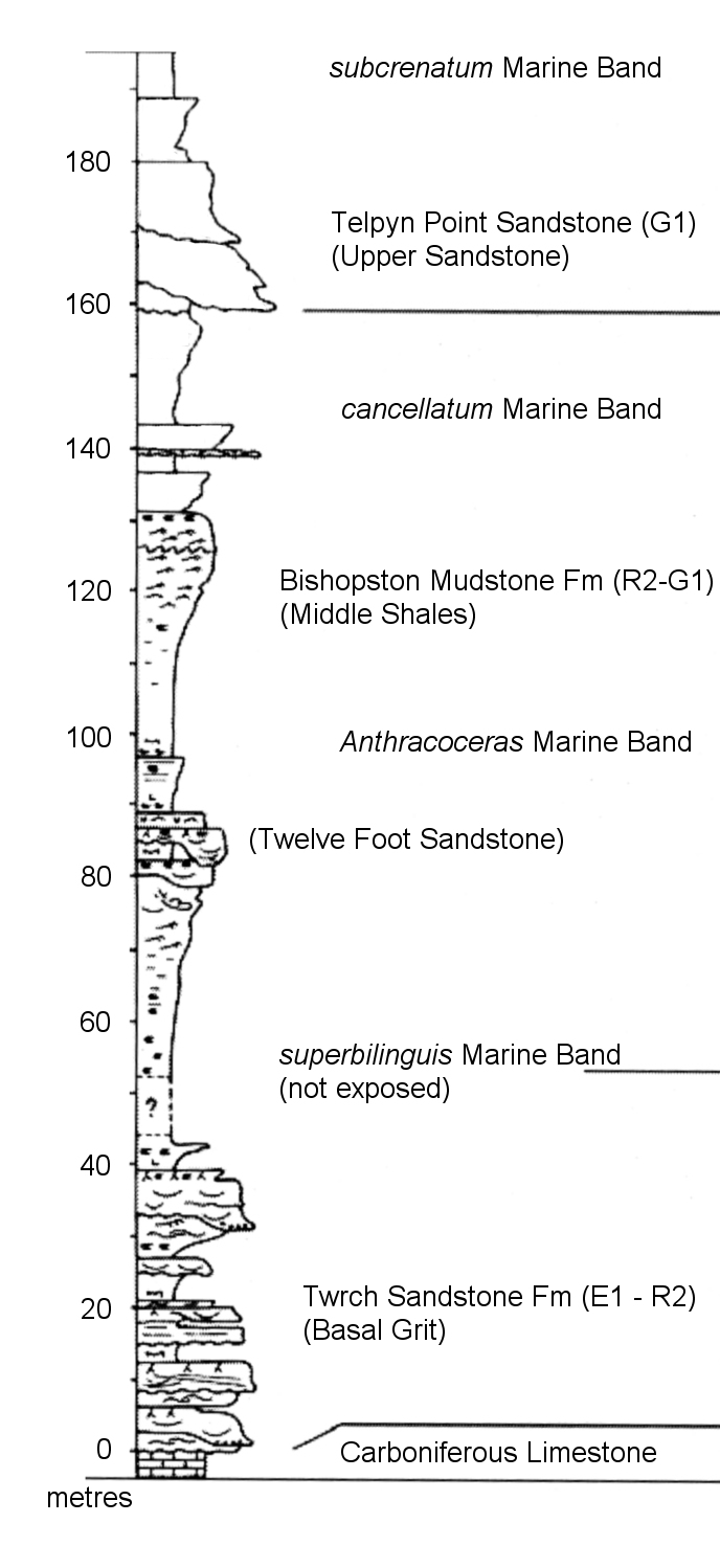
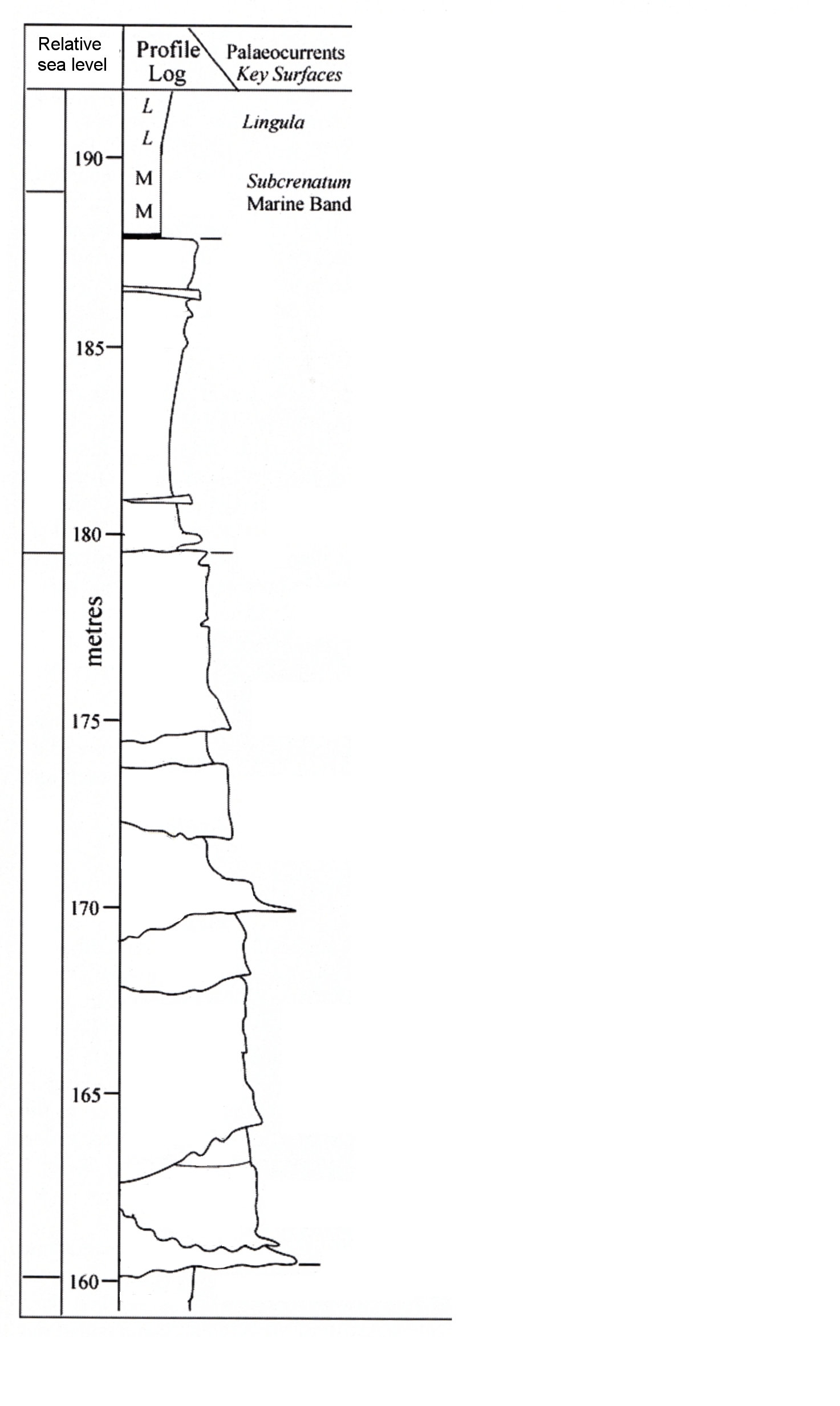
You will complete annotated versions of Log 1 and Log 2 (separate sheets provided in your base maps file) as part of your task. This is best accomplished by printing these sheets out, and writing on them. An alternative is to work on the logs in PowerPoint slides, using text boxes and drawing tools to annotate them. Log 2 is an enlargement of the top part of Log 1, though the Telpyn Point Sandstone.
|
Log 1. Our coastal traverse starts at 98 m on the log, so ignore the part of the section below 98m. |
Log 2. This is an enlargement of the upper part of Log 1 - the Telpyn Point Sandstone |
Field evidence
The information and photographs below are located on the log by height. Use them as evidence on which to base your interpretations. Remember to click on the images to enlarge, so that you can see maximum detail.
| Height in section (metres) | Description | Photographs and questions | ||
| Base of section not seen - obscured by superficial deposits | ||||
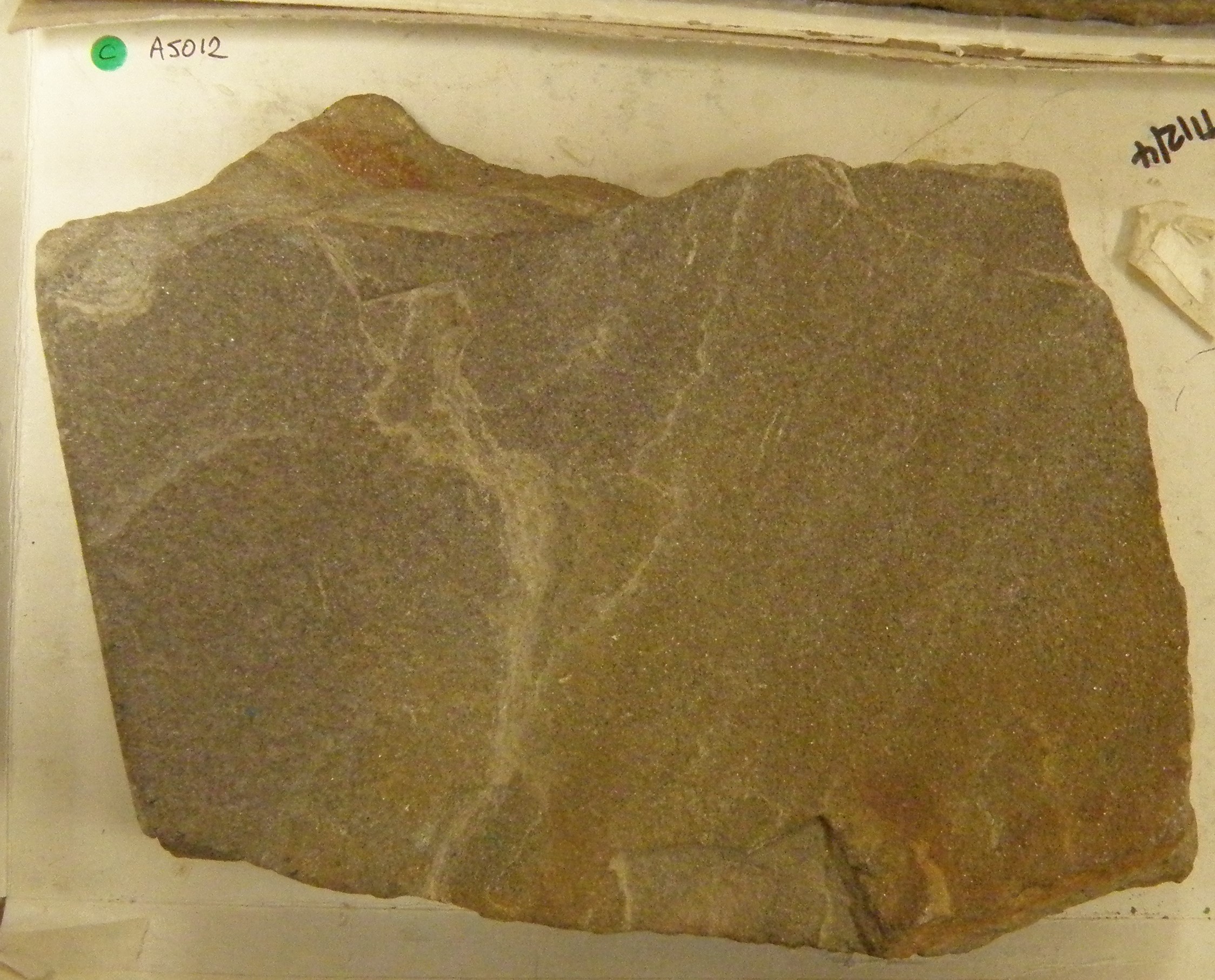
| 98 -100 |
dark micaceous mudstones contain the fossils Carbonicola and Anthracoceras |
|||
|
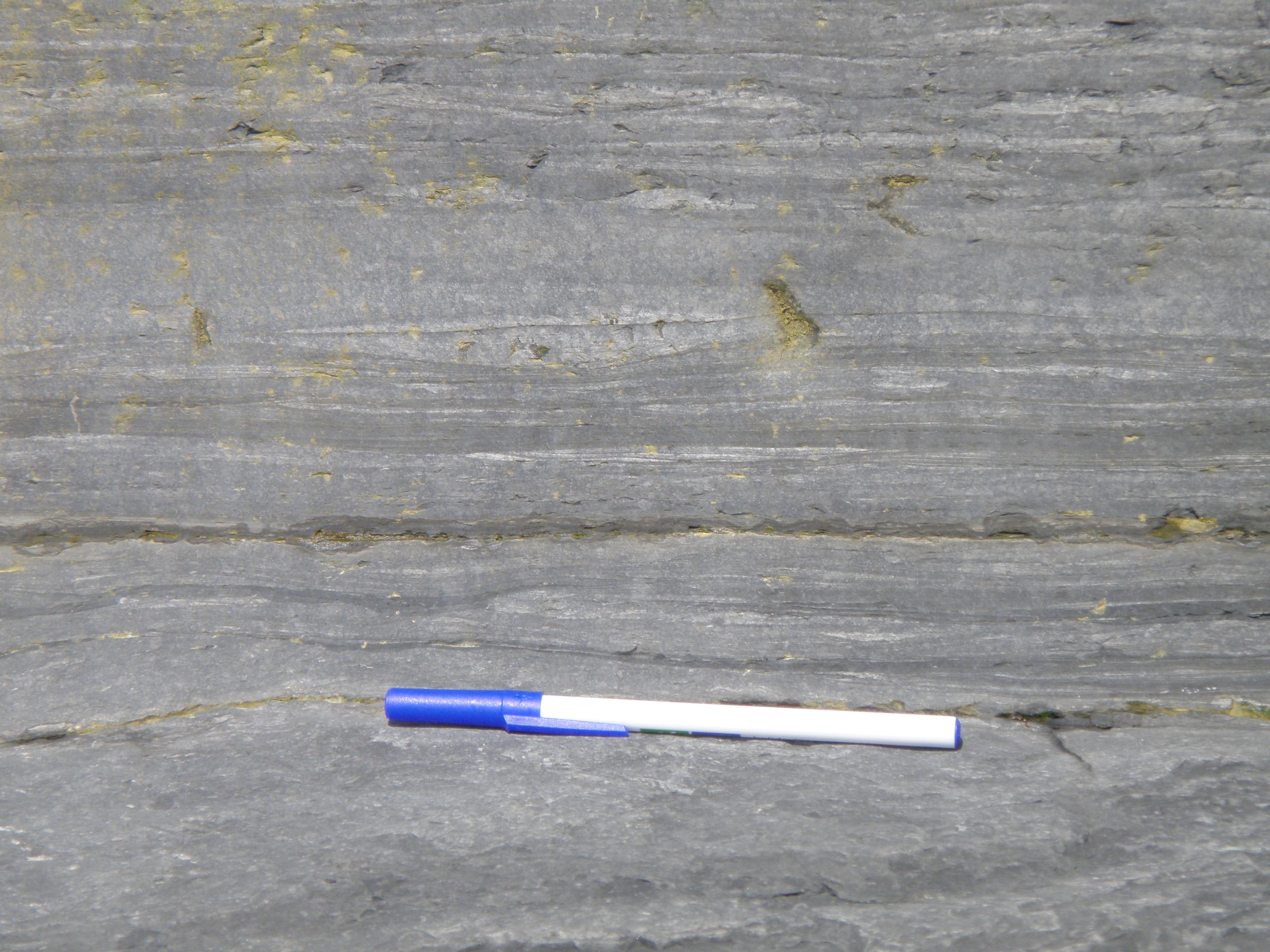
100 - 110 |
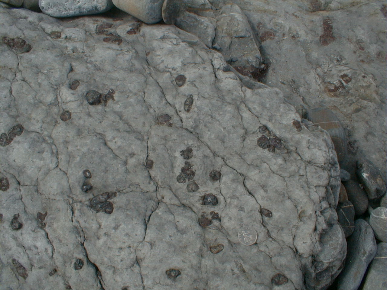
Striped silty mudstones. Common thin ironstone bands & nodules |
 100m on section |
|
What does the presence of siderite tell us about conditions during early diagenesis? Look carefully at the laminations. Is there any evidence of bioturbation? What conclusions do you draw? |
|
110 - 119 |
Gradual passage up from previous unit into medium grey sandy siltstones. Sandstone as discontinuous streaks and wavy laminations. Trace fossil Planolites on some bedding surfaces. |
Note changes in colour - what do they signify about upward changes in lithology? |
 119m |
|
|
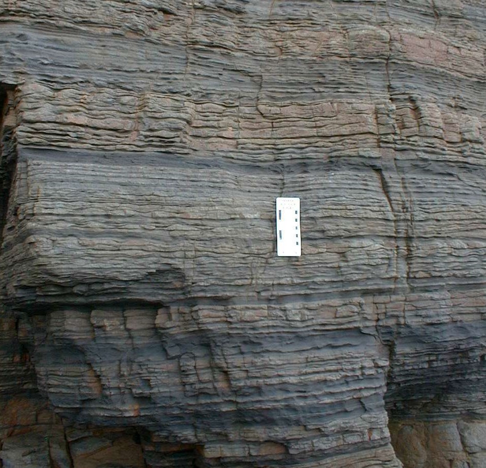
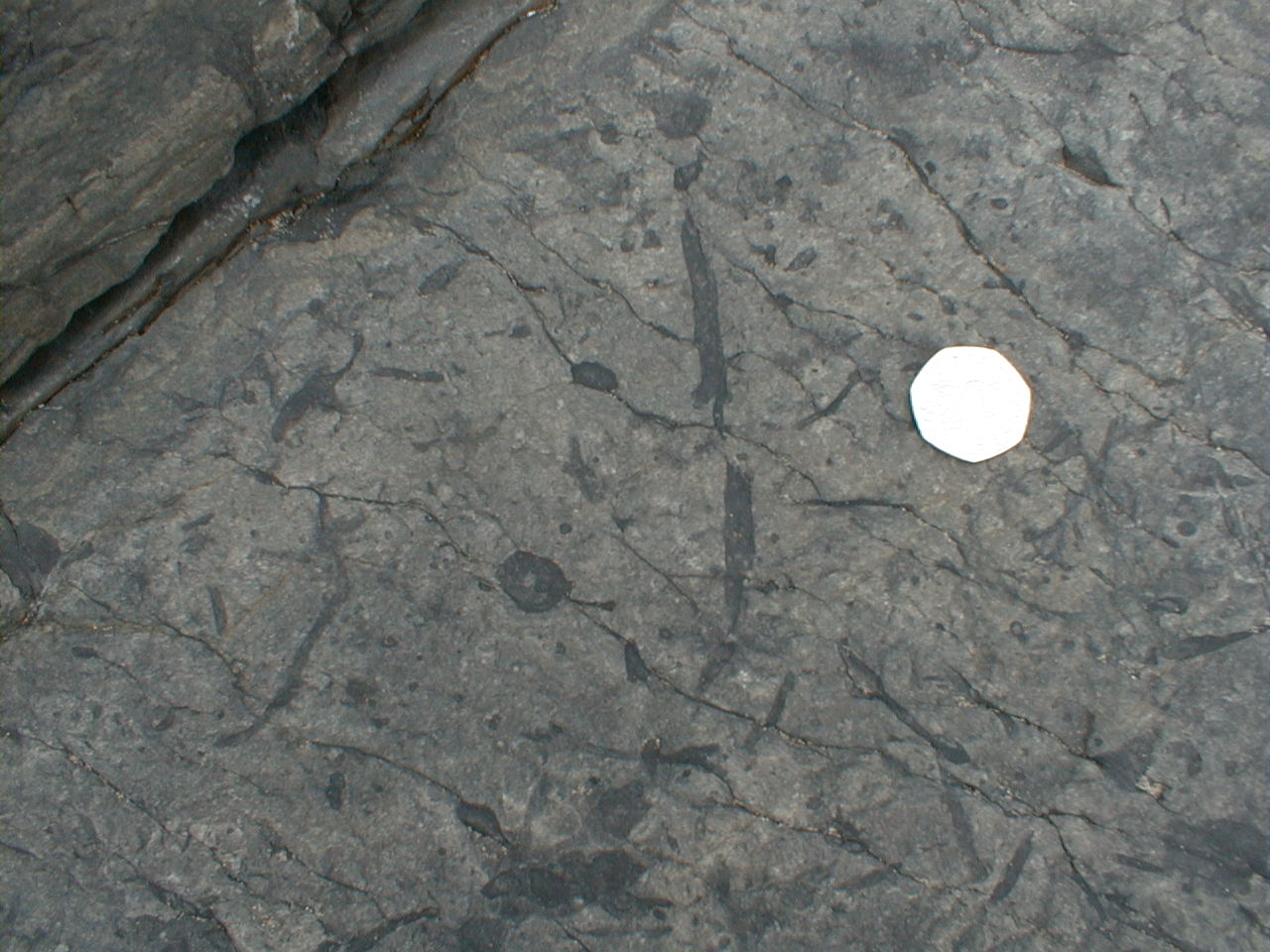
119 - 131 |
Gradual passage up
from previous unit into fine micaceous sandstones showing current ripple
cross-lamination, thinly interbedded with wavy siltstones. Rib-and-furrow
palaeocurrents to NW. Plant debris near base. Rare burrows and ironstone
(siderite) nodules throughout. |
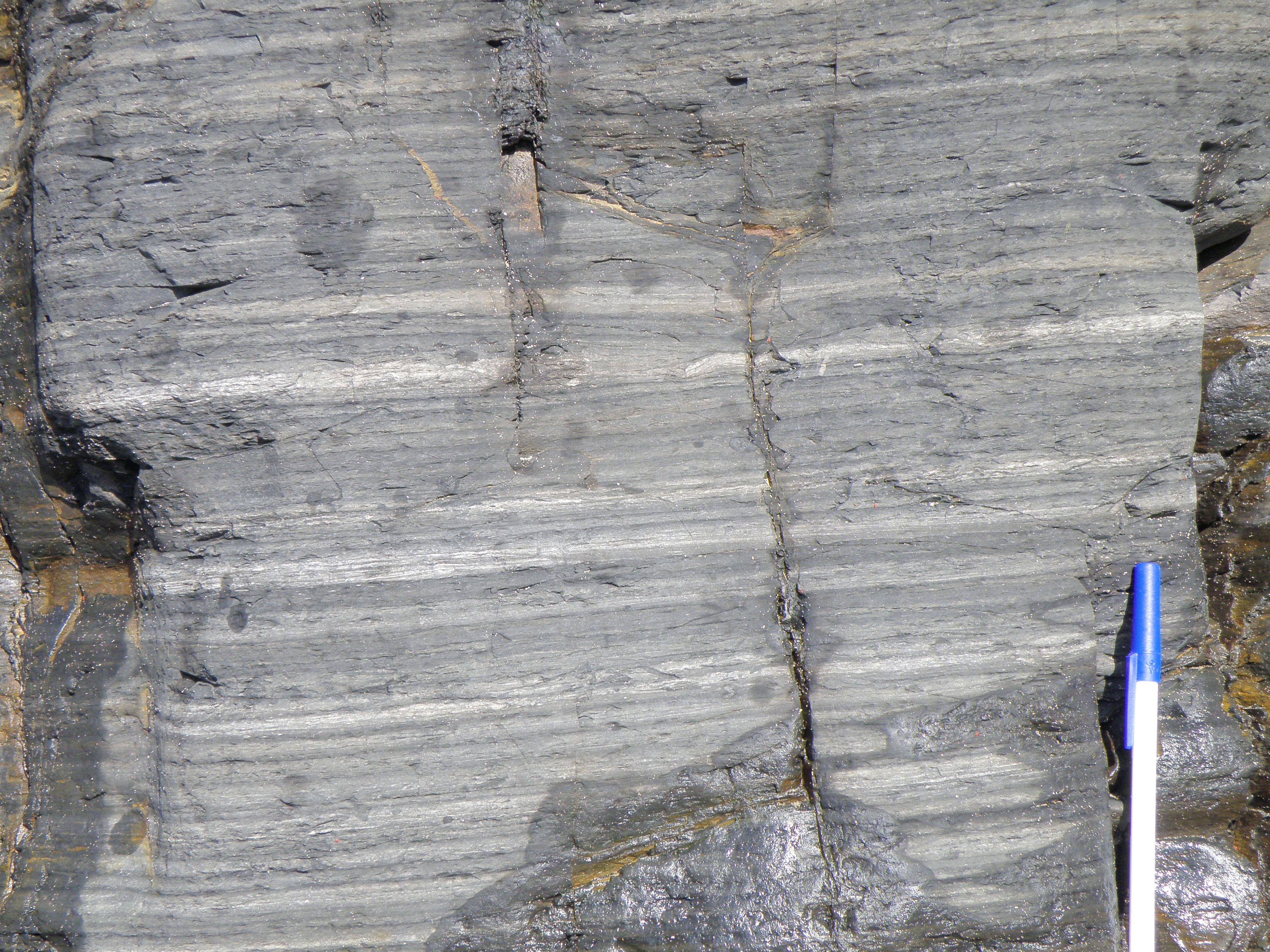 121m |
|
|
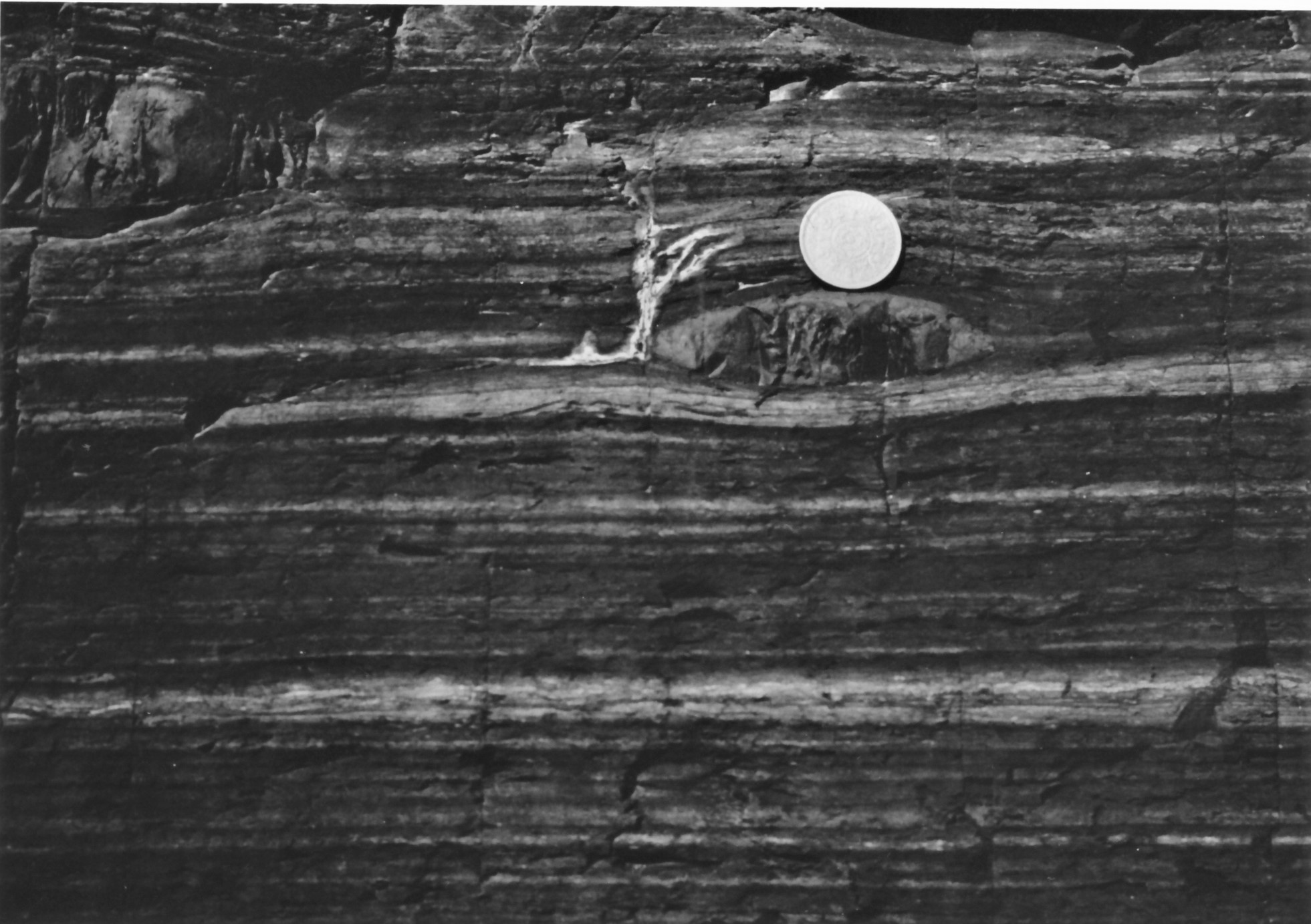
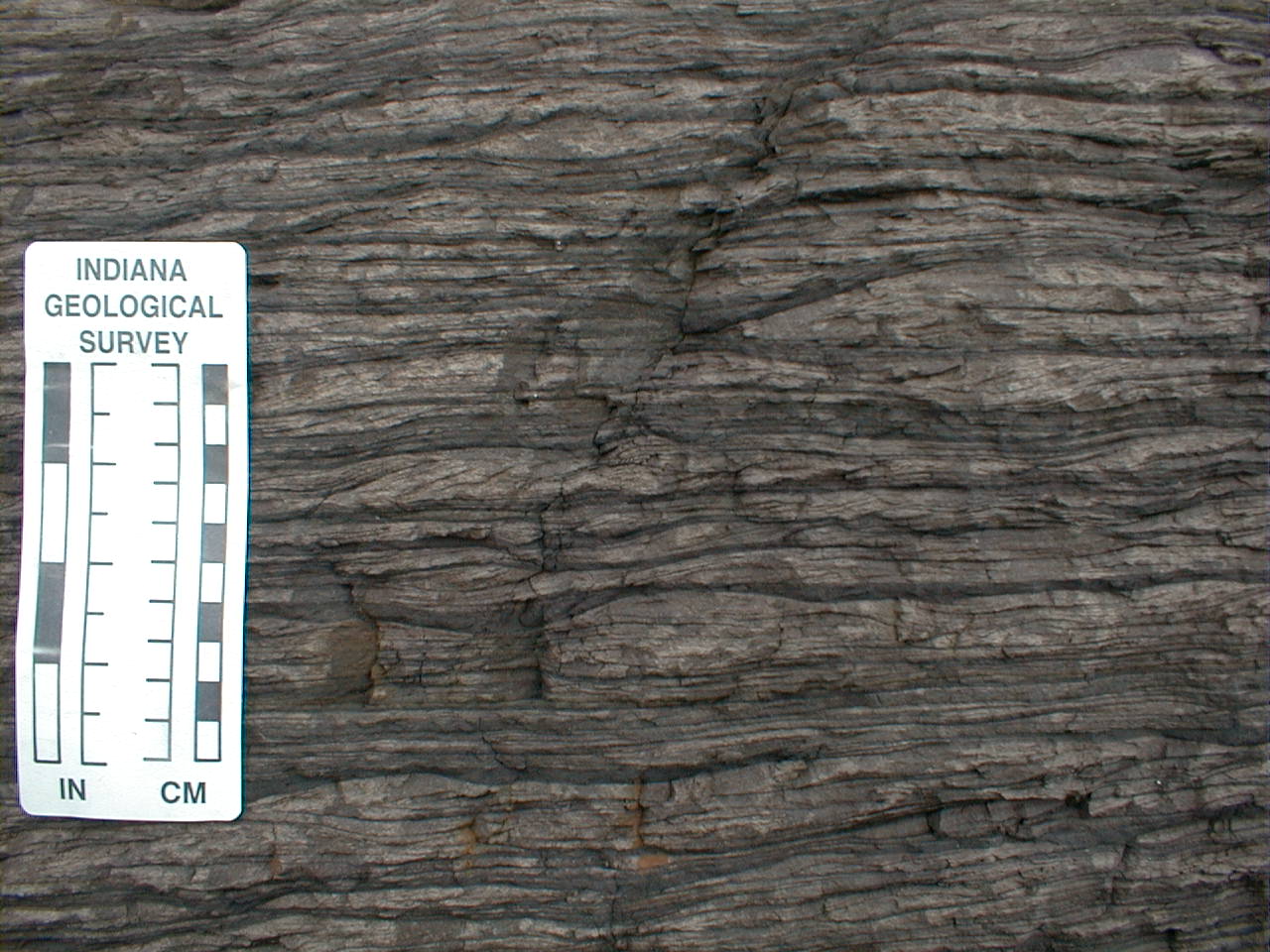
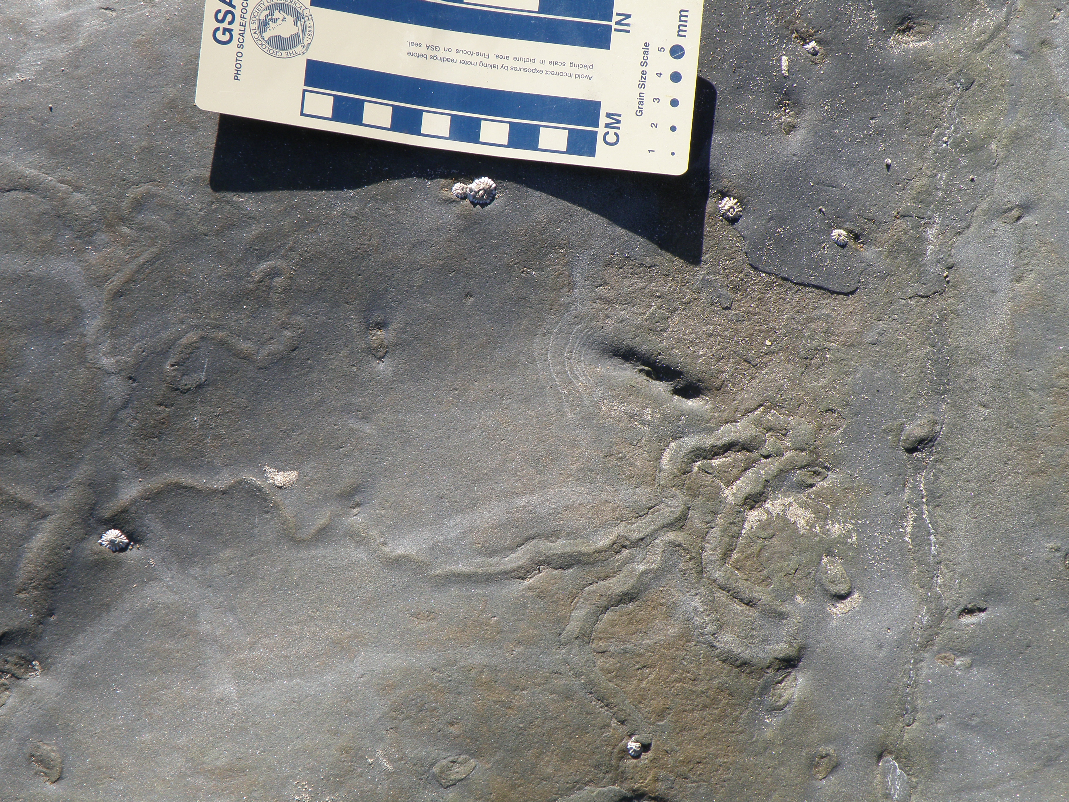
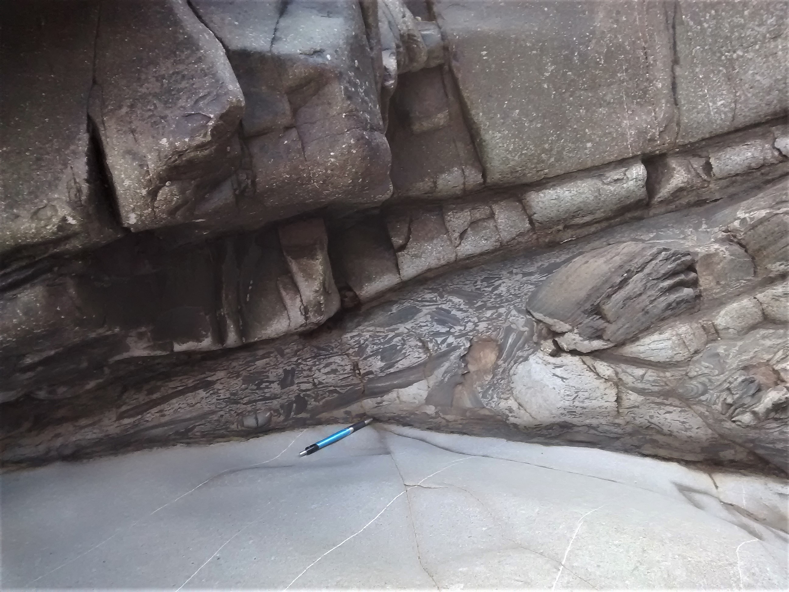
 This outcrop occurs at around 124m. Sandstone is light-coloured; mudstone is dark. The right-hand side of the scale is marked in cm. |
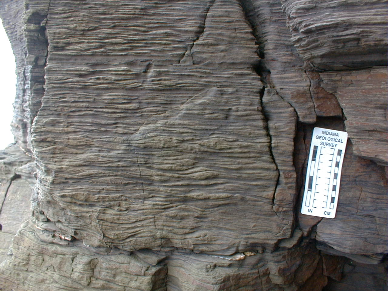 Close-up of photo to left. |
|
||
| 131 - 137 | sharp base; siltstones with sandy streaks & lenticular bedding passing up into sandy siltstones with symmetrical ripples. Ripple crests are oriented E-W. Some plant debris, common bioturbation. Trace fossils include Rhizocorallium & Teichichnus. ?Rootlets at top | |||
| 137- 139.5 | sharp, planar base; dark grey mudstone with solitary rugose corals and fragments of crinoids and brachiopods | |||
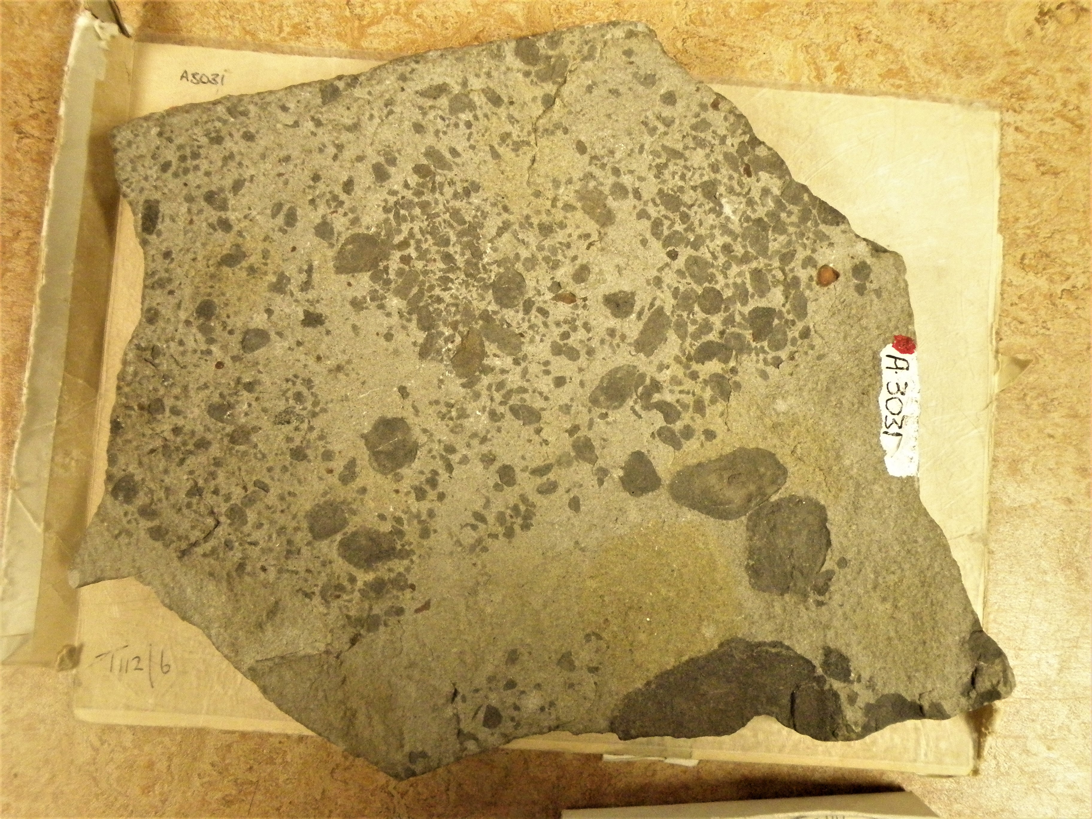
| 139.5 - 140 |
sharp, erosional base; coarse sandstone with pebbles of quartz, mudstone & black phosphatized material - lag deposit |
|||
|
140 - 142.5 |
Sharp base; silty sandstone, coarsening up. Current ripple cross-lamination and low-angle cross bedding. Palaeocurrents to WNW, NNE and E. |
 141m |
 142m |
|
|
142.5 - 145 |
Sharp base; dark mudstone containing goniatites including Gastrioceras cancellatum (this is the cancellatum Marine Band) |
 145m |
What is a marine band? Why are marine bands restricted to thin horizons in the shaly parts of the section? Why do most of the shales not contain marine band fossils? | |
|
145 - 162 |
Gradational base; parallel-laminated siltstones with lenses and streaks of sand, becoming more sandy upwards. Symmetrical ripple crests in sandstones above 155m are oriented from E-W to NE-SW. Trace fossils include Scolicia. |
|
||
|
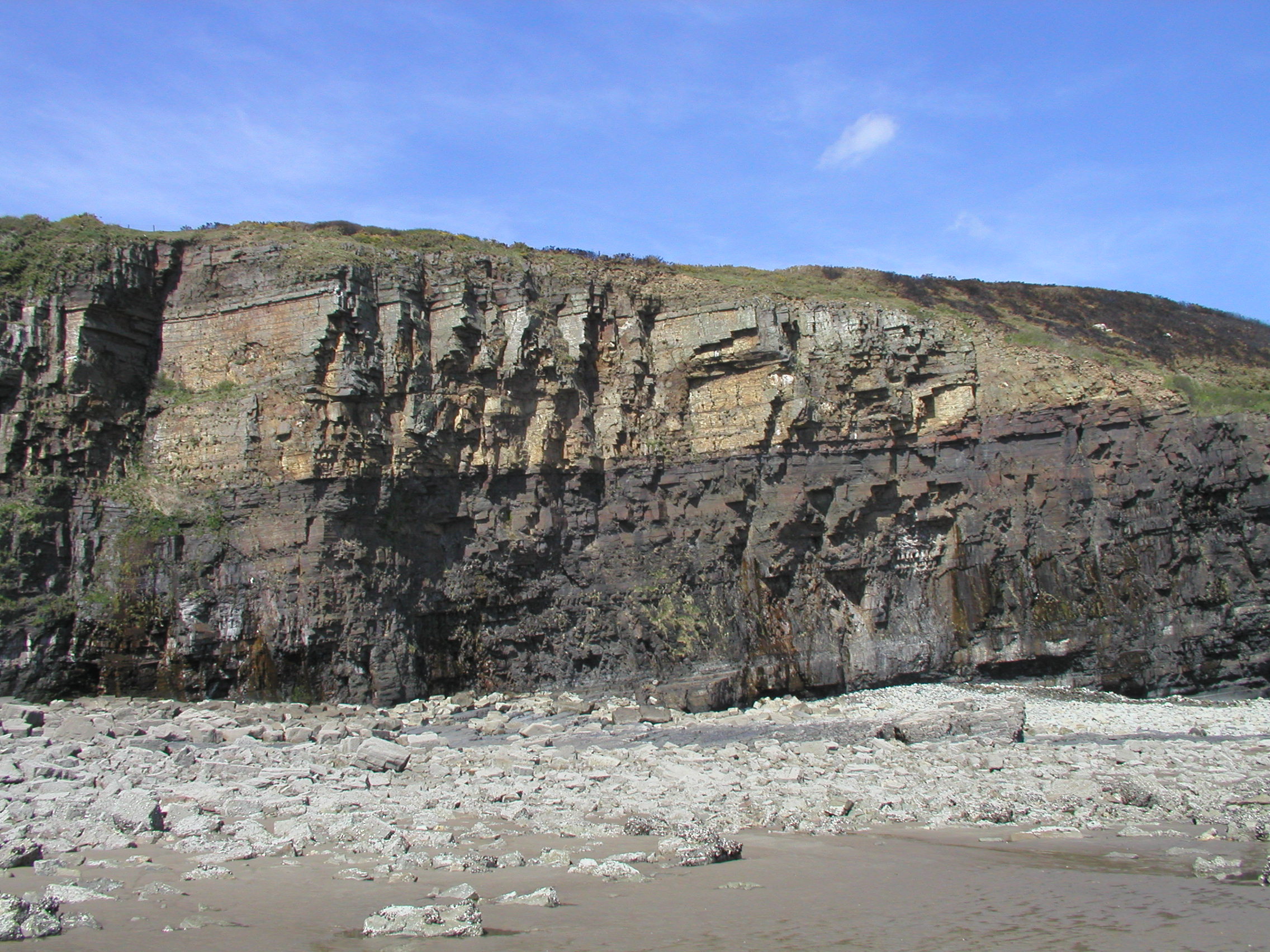
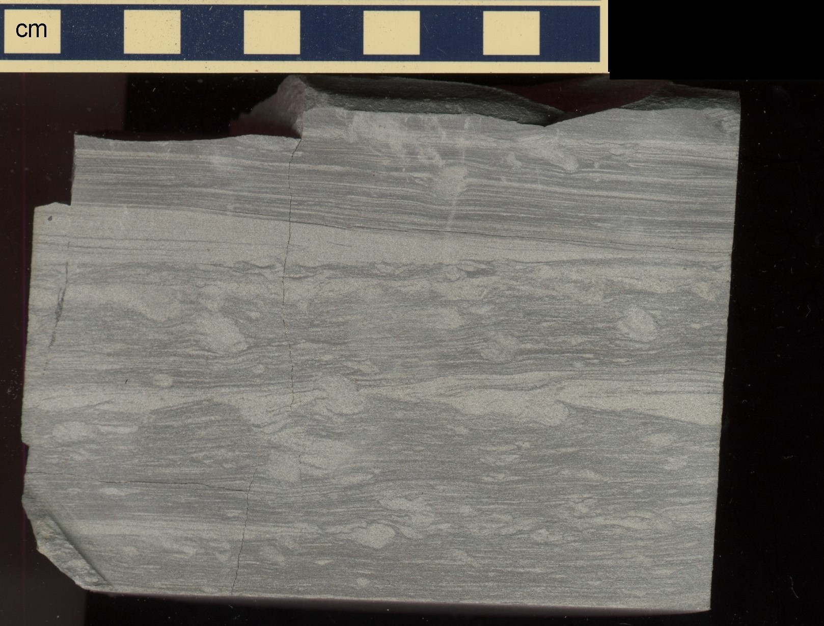
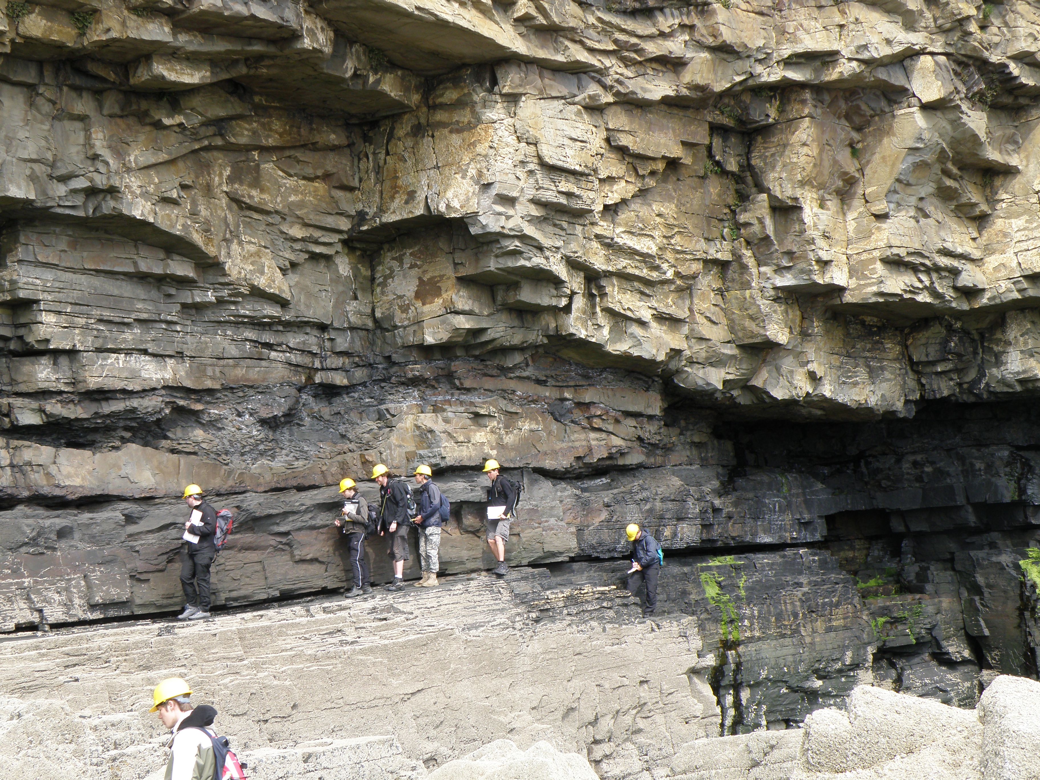
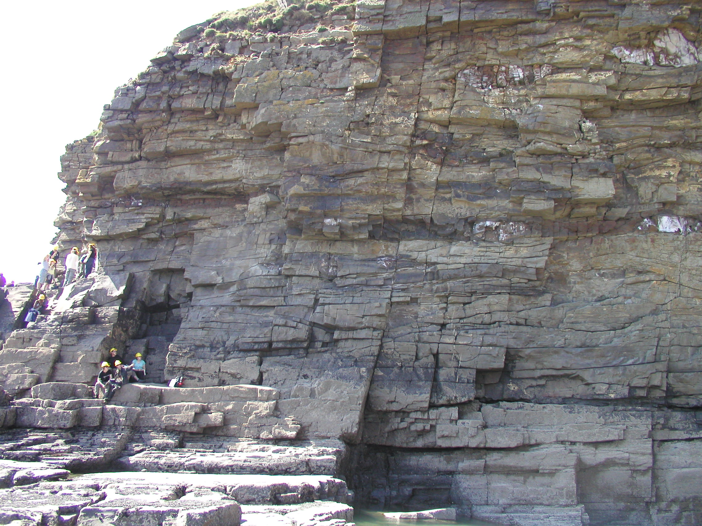
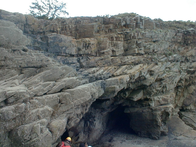
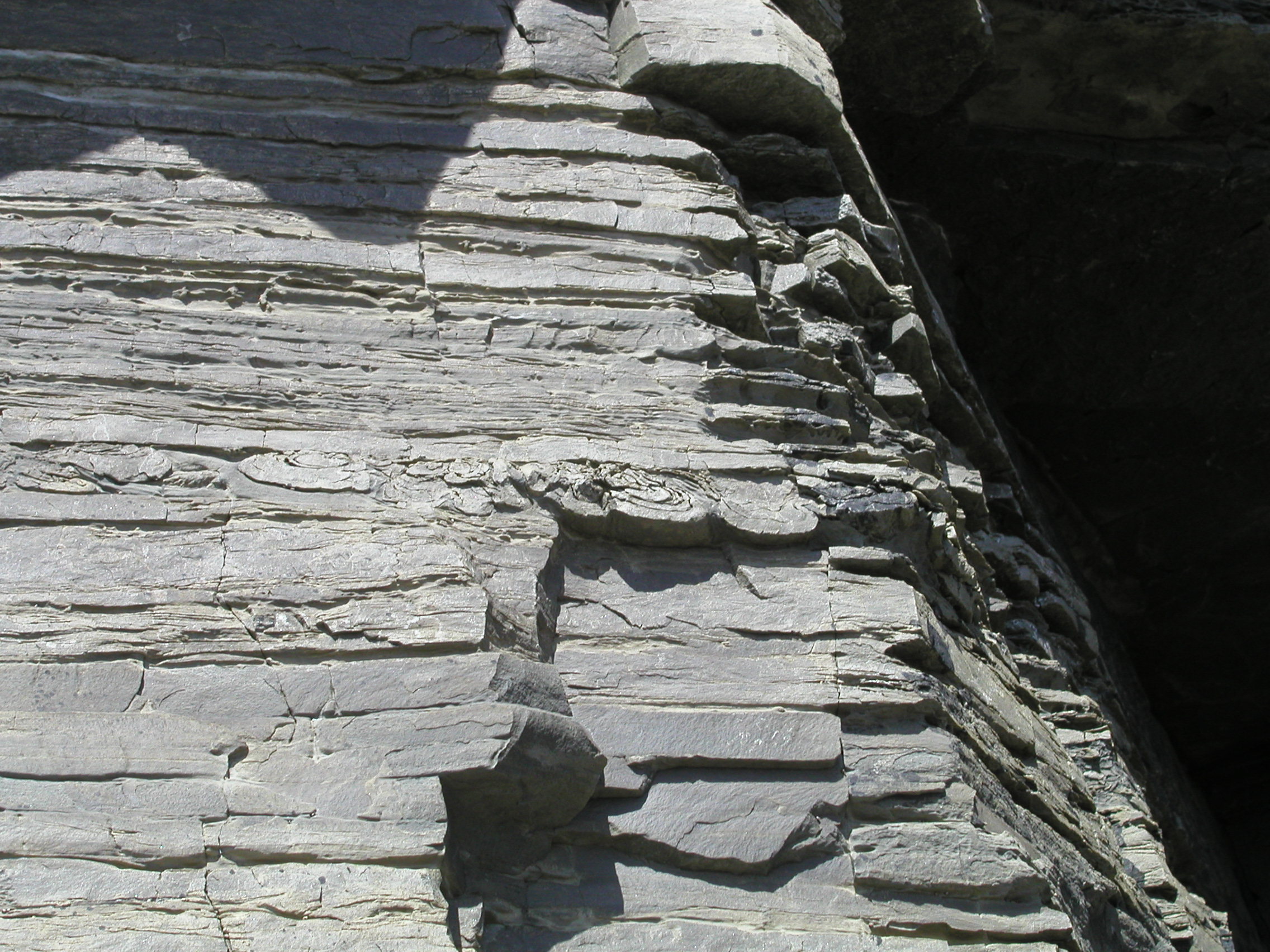
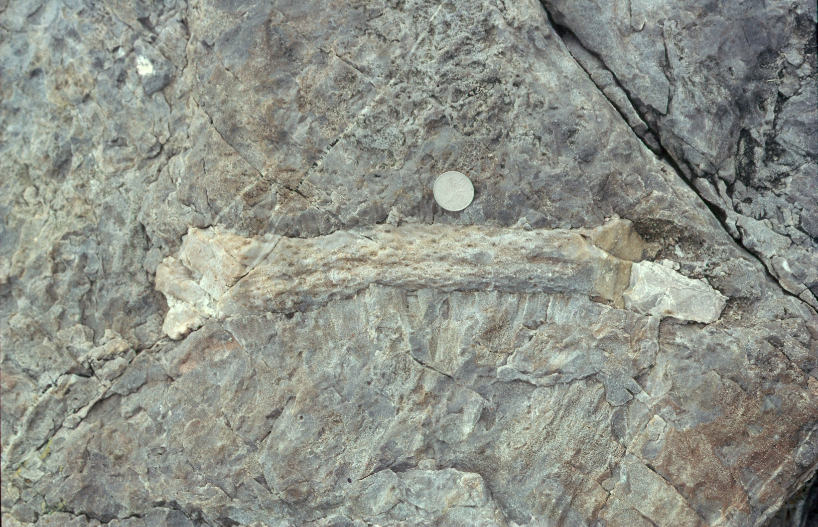
162 - 172.5 |
Sharp erosional base of the Telpyn Point Sandstone (TPS) cuts down at least 2m into the underlying beds. These coarse to medium sandstones show large-scale trough cross-bedding, with palaeocurrents towards the SW. There are several units, separated by erosion surfaces - this could be termed a multi-storey sandstone. |
 Approximately 155 to 169m . The base of the Telpyn Point Sandstone at around 160m is just below the obvious change from dark- to light-coloured rocks. |
 155 to 164m |
 Lower part of the TPS from about 162m upwards |
 163m |
|
 165m [photo from TPS at Tenby] |
||
 167m |
 168m |
 172m |
||
| 172.5 - 174 | Coarse, sharp-based massive sandstone. Flutes on base show palaeocurrents between SSE and E | |||
| 174 - 179.5 |
Sharp base. Several sharp-based beds of medium to fine sandstones, mostly showing current ripple cross lamination or parallel lamination. Rib-and-furrow gives palaeocurrents towards the SE |
 Section from ~175m upwards |
 175 to 176m |
|
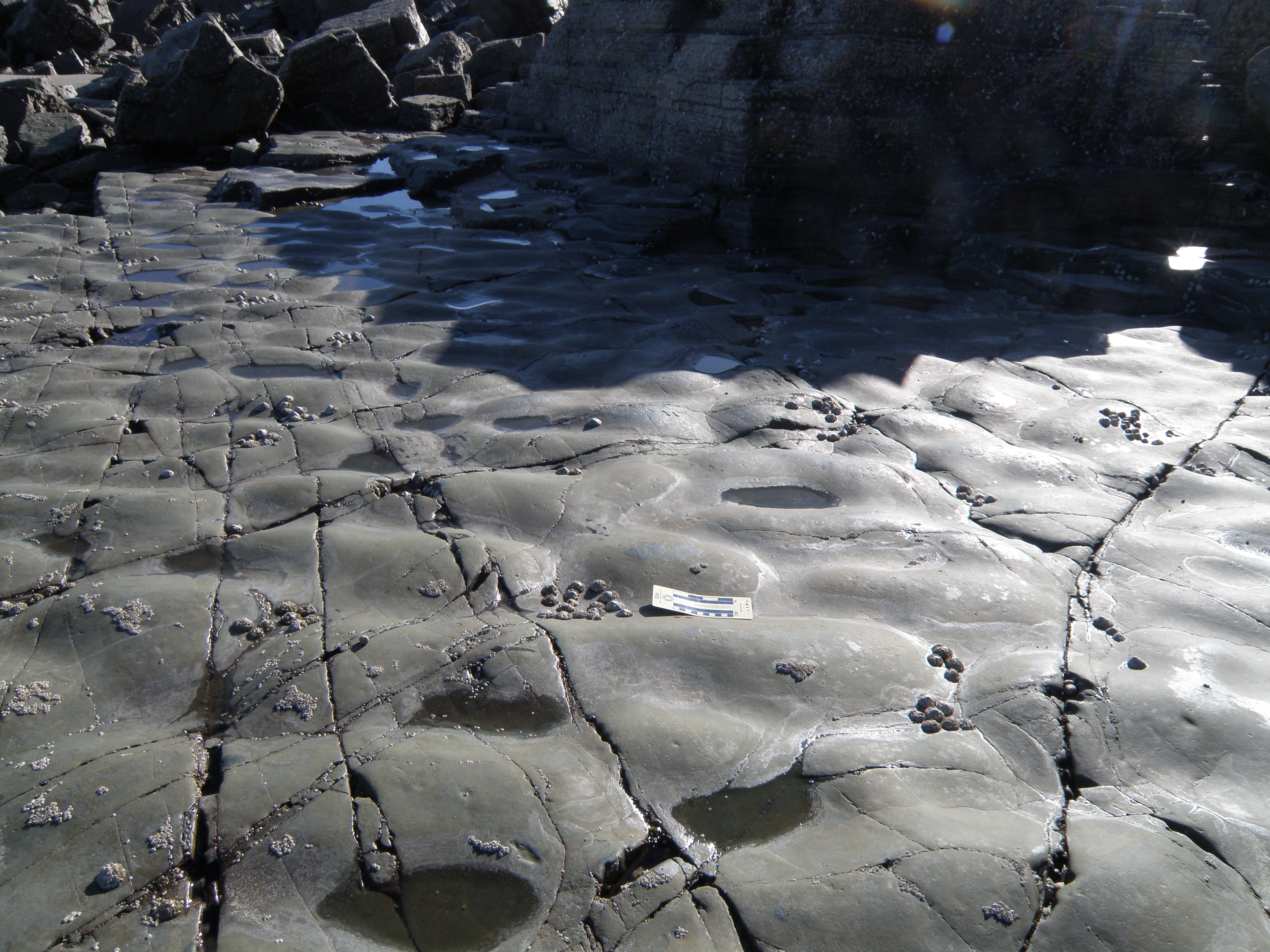
| 179.5 - 188 |
Fine sandstones pass gradually upwards into siltstones with thin rippled sandstone interbeds. Current ripple directions range from SW to SE The top surface of the siltstone shows a number of interesting features. |
 Top of the nearest outcrop is at 188m |
 188m |
|
 188m |
 188m |
|||
| 188-188.3 | A thin, poorly exposed coal | |||
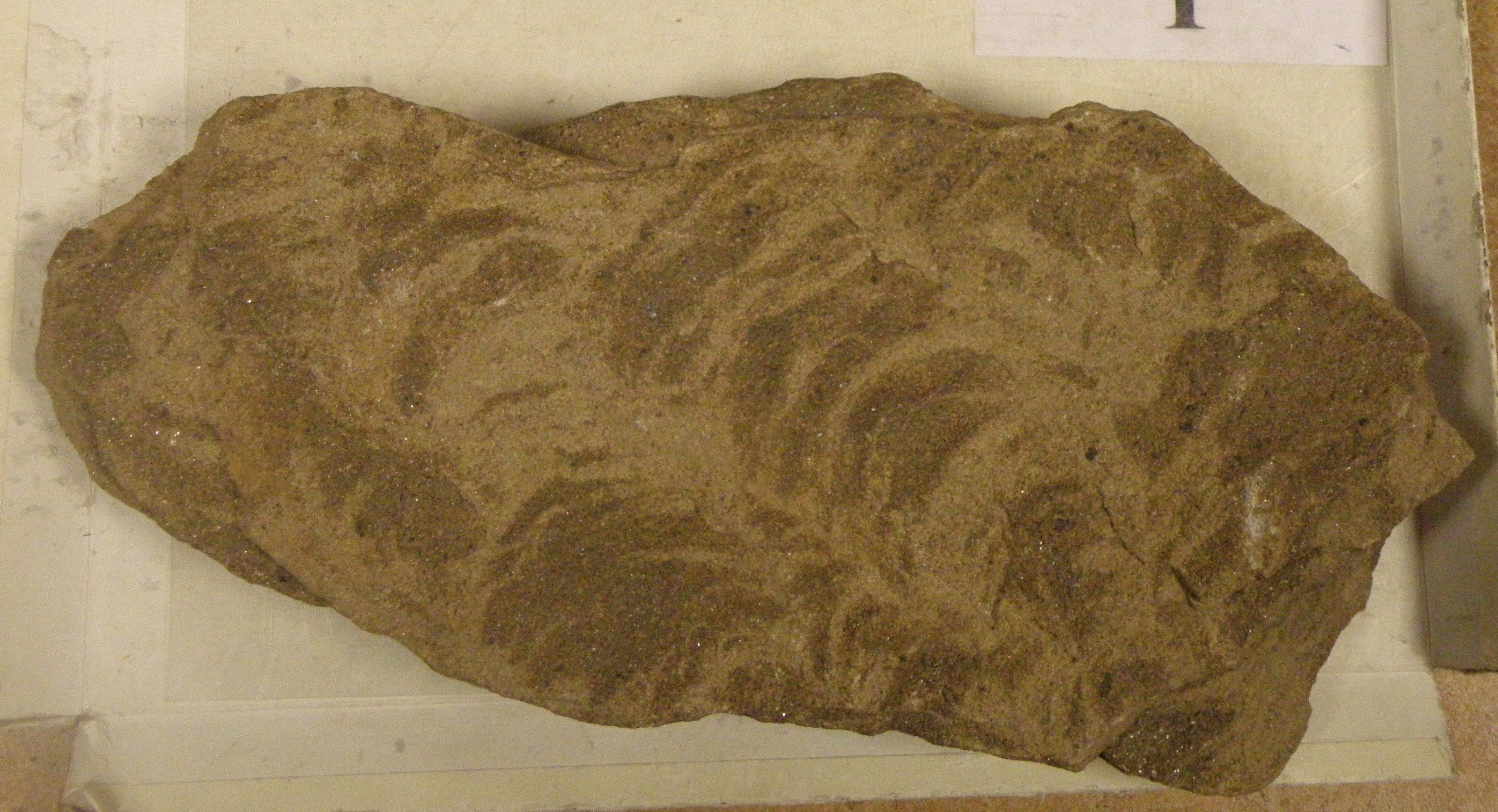
| 188.3 - 192 |
Dark grey shales containing Gastrioceras subcrenatum near the base - this is the subcrenatum Marine Band. Higher up, the fossil on the right is commonly seen.
Top of section not seen. Above lies the Westphalian section at Locality 4.1 |
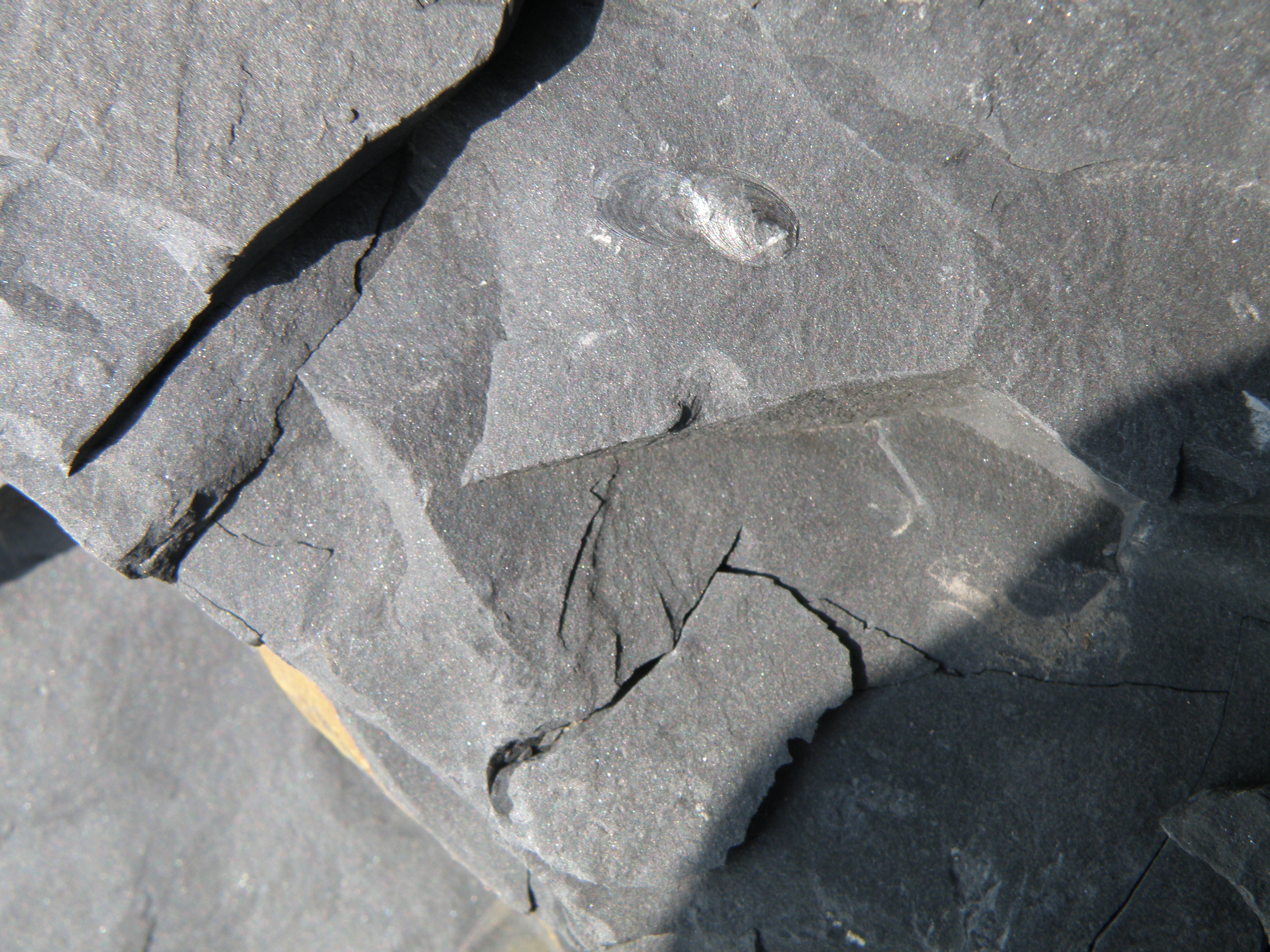 191m |
||
Interpreting the Sedimentary Log
You have now acquired a variety of different types of data on the sedimentary sequence shown in the log. This includes lithology, sedimentary structures and field relationships seen in photographs and samples, and a palaeocurrent plot. Your task now is to interpret the data.
![]()
![]()
Make sure you've completed all the work for this traverse, the last major locality of the field trip. Now we can get back on the virtual coach and head home to Derby, with some geological observations and stops along the route.
![]()
This page is maintained by Roger Suthren. Last updated 30 April, 2020 12:41 PM . All images © Roger Suthren unless otherwise stated. Images may be re-used for non-commercial purposes.